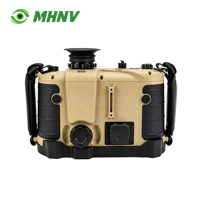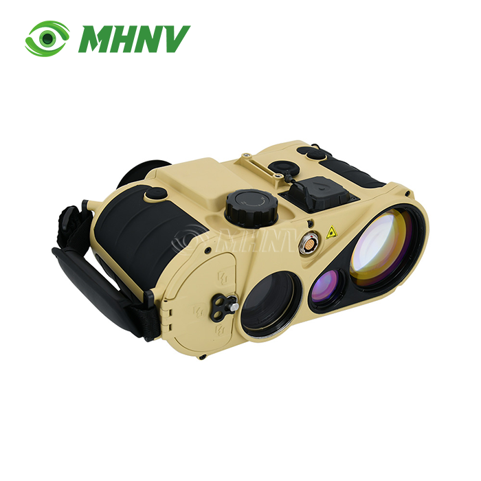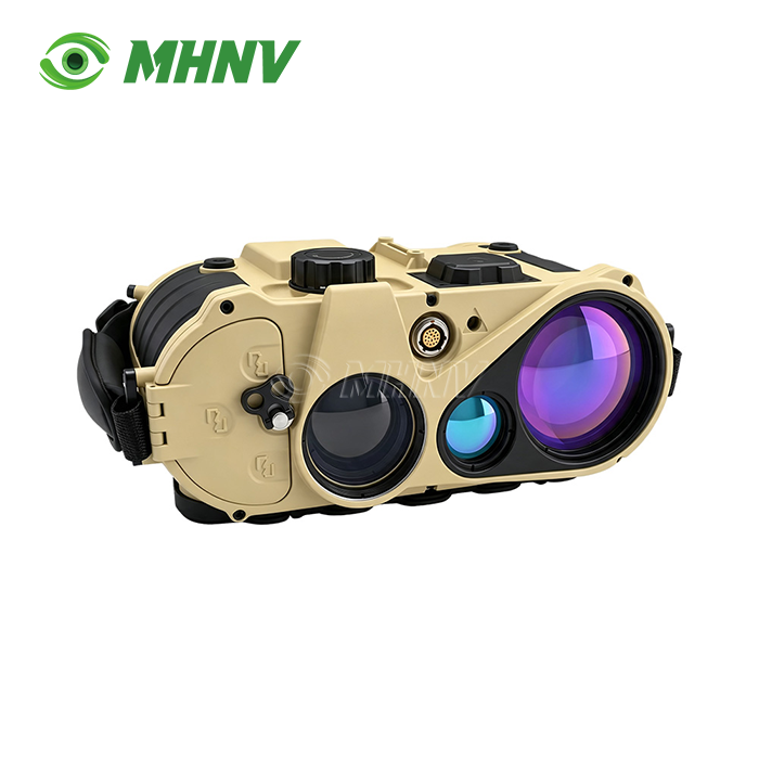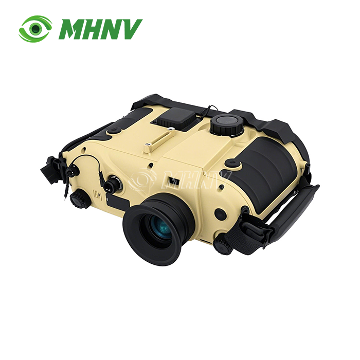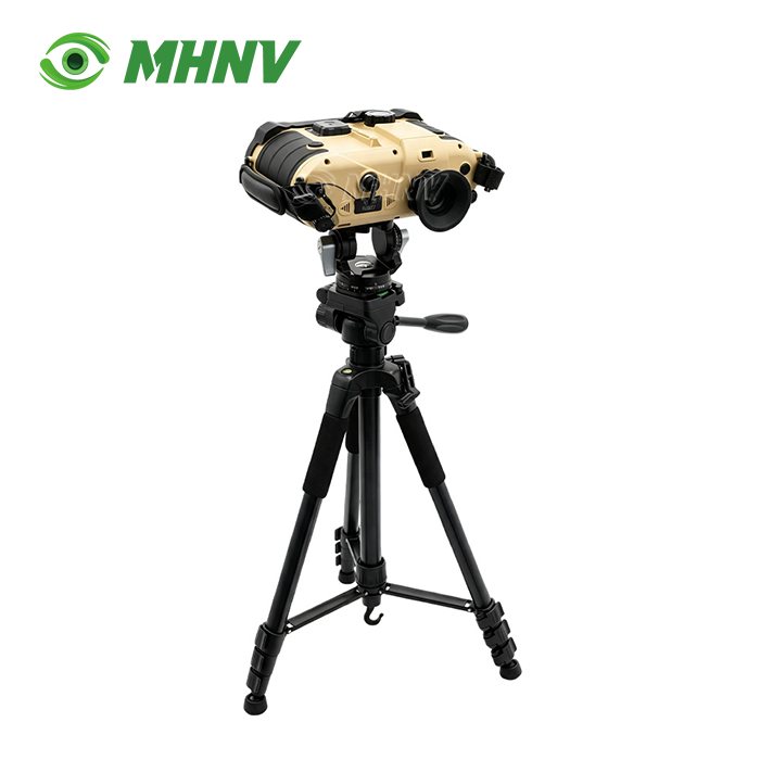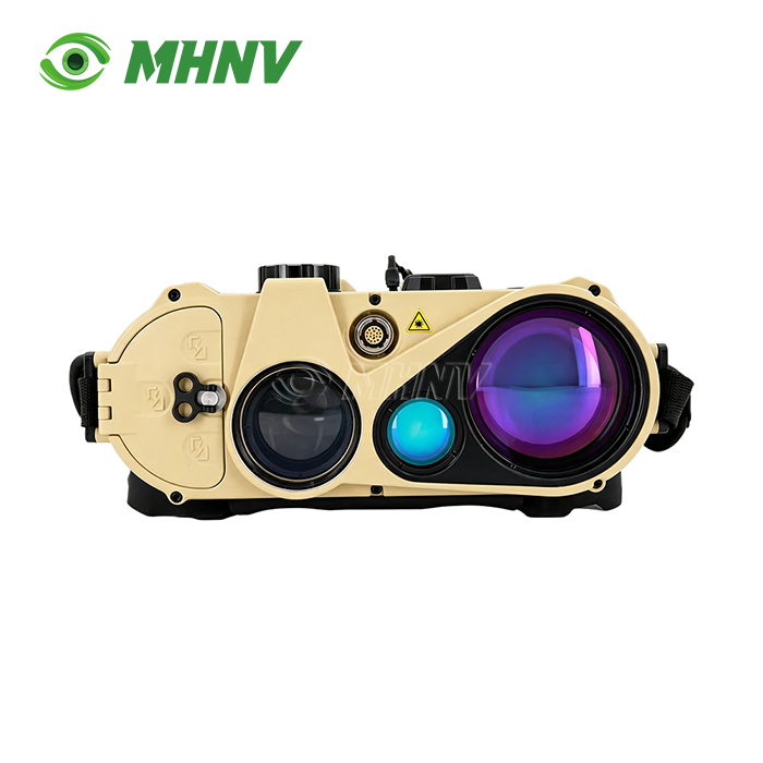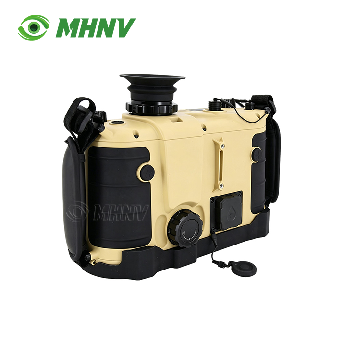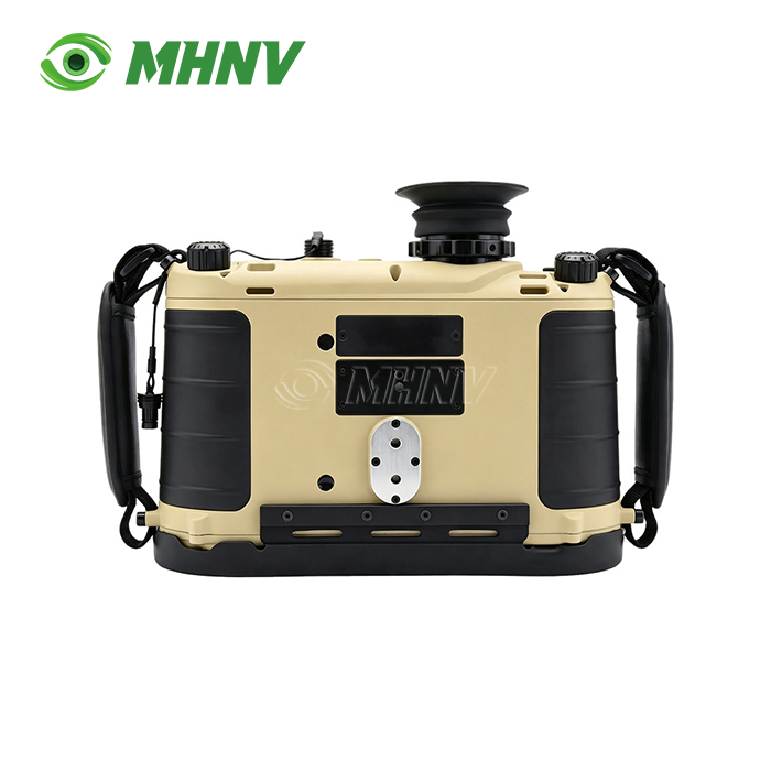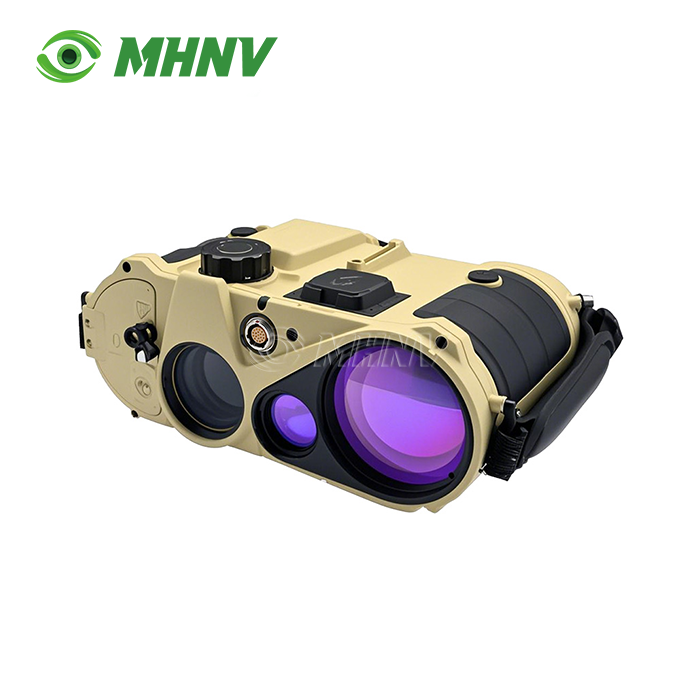
Laser Rangefinder Target Locator Binocular
Professional Handheld Laser Rangefinder Target Locator Binocular with 23km Ultra-Long Range and Sub-Mil Accuracy for Precision Observation
Xi'an MH Electronics And Technology Co., Ltd. introduces the MHNV MH-OL20, an enterprise-grade Laser Rangefinder Target Locator Binocular engineered for ultra-long-range target acquisition. This professional-grade observation system integrates 7x direct-view optics, 23 km eye-safe laser ranging, digital compass and GPS positioning into a 732 g handheld body. The device delivers 0.06° (1 mil) azimuth accuracy after map correction, ≤20 m target positioning accuracy at maximum range, and 10+ hours continuous runtime. Class 1 eye-safe 1535 nm laser reaches 23 km on building targets and 9 km on vehicle-size targets, while IP67 sealing and −40°C to +60°C operating range ensure reliable performance across arctic, desert and coastal environments.
Unmatched Long-Range Capability in Compact Form
This product is a new standard portable observation system that provides tripod-class performance in a patrol-pouch size. The MH-OL20 can measure up to 23 km on reflecting building targets and 9 km on vehicle-size targets, whereas typical handheld rangefinder binoculars are limited beyond 5 km. This extended range allows coastal watch teams to monitor shipping lanes beyond the horizon, border security units to track cross-border movement at ranges that previously required vehicle-mounted systems, and forward observers to correct artillery fires at ranges where small positional errors are mission failure.
The 1535 nm Class 1 eye-safe laser eliminates operational restrictions of higher class systems. You can fly non stop through populous regions, friendly persons and reflective coastal surfaces without activating ocular hazard measures. The direct-view 7x optical channel allows you to keep your observation capability in case of complete electronic failure – a backup mode that is not possible with fully-digital systems.
Sub-Mil Accuracy for Precision Fire Control
Hitting precise targets at extended range requires more than long laser sight. The built-in digital compass has a field azimuth accuracy of 0.3° (5 mil), which can be enhanced to 0.06° (1 mil) by map correction. The pitch and roll sensors are accurate to 0.1° (2 mil), giving a full angular solution equivalent to less than 20 m circular inaccuracy at a range of 15 km. That's accurate enough to guide first-round artillery corrections and coordinate drone strikes — things consumer-grade systems, accurate only to 3-5 m and only out to around 3 km, can't do.
Measuring distance to several targets at once gives you an added tactical dimension. Lock on two targets and read the exact distance between them—critical for calculating spacing in a convoy, measuring fall-of-shot during a fire operation, or determining bridge spans for mobility planning.
Integrated Command-Post Data Fusion
The RS232 provides comprehensive data output streams including, compass bearing, GPS coordinates, target grid and ballistic solutions directly to command computers, drone ground stations and battle-management systems. This removes laborious voice call-out and paper transcription, shrinking observation to fire timeframes from minutes to seconds. The on-board ballistic computer, with on-line meteorological input and individual munition data, provides drop and windage corrections for accurate engagement without outside calculations.
Your operations crew is given live targeting data integrated into current C4ISR infrastructure. The scalable digital picture interface is future-proofed for expansion to networked observation infrastructures.
Extended Mission Endurance and Environmental Resilience
Ten hours of continuous runtime on internal power supports full-shift operations without battery swaps. Whether you're conducting extended coastal surveillance, multi-day forward observation or sustained border patrol, the MH-OL20 eliminates mid-mission logistics that compromise observation continuity.
IP67 sealing protects against dust ingress and full immersion, while the −40°C to +60°C operating envelope covers arctic permafrost, desert heat and tropical humidity. The same device deploys reliably across every climate zone your organization operates in, avoiding the cost and complexity of maintaining climate-specific device fleets.

Technical Specifications
| Parameter | Specification |
|---|---|
| Model | MHNV MH-OL20 |
| Optical Magnification | 7x ±0.3x |
| Laser Wavelength | 1535 nm eye-safe |
| Laser Safety Class | Class 1 |
| Maximum Range (Building) | ≥23 km |
| Maximum Range (Vehicle) | ≥9 km |
| Minimum Range | 50 m |
| Azimuth Accuracy (Field) | ≤0.3° (5 mil) |
| Azimuth Accuracy (Map-Corrected) | ≤0.06° (1 mil) |
| Pitch/Roll Accuracy | ≤0.1° (2 mil) |
| Self-Positioning Accuracy | ±3 m |
| Target Positioning Accuracy | ≤20 m |
| Ballistic Calculator | Integrated with meteorological input |
| Data Interface | RS232 full data transmission |
| Dimensions | 190 × 240 × 100 mm |
| Weight | 732 g |
| Continuous Runtime | ≥10 hours |
| Operating Temperature | −40°C to +60°C |
| Ingress Protection | IP67 |
Why Choose MHNV for Your Observation Equipment?
Xi'an MH Electronics And Technology Co., Ltd. has manufactured precision optoelectronic systems such as Laser Rangefinder Target Locator Binocular since 2013. Our full-stack engineering competence from optical design, FPGA processing, embedded firmware, algorithms for artificial intelligence and mechanical design, gives us complete control from initial concept to final assembly. Unlike trade firms, we have the whole production chain, including Class-10,000 Cleanrooms for calibration, SMT lines for electronic assembly and specialised metrology laboratories.

Quality is verified for each item in compliance with the ISO 9001:2015 regulations and MIL-STD-810 environmental standards. We offer full OEM and ODM customisation on optical configuration, firmware interface, mechanical housing, and packaging. We assist customers in 60+ countries with bilingual technical support, which allows us to respond quickly to projects and ensure long-term partnership stability.

FAQ
Q: What is a product and how does it improve operational efficiency?
A: A product is an advanced multi-functional optoelectronic system that integrates long-range observation optics, high-precision laser distance measurement, digital magnetic compass, GPS positioning and often ballistic computation into one handheld device, specifically engineered to eliminate the traditional observation-to-action lag by automatically fusing self-location with measured distance, azimuth and inclination to calculate precise target coordinates without manual computation. This automation reduces human error and accelerates response times in time-critical scenarios where delayed targeting translates directly into mission failure or asset loss.
Q: How does atmospheric interference affect measurement reliability in coastal or humid environments?
A: Fog, heavy rain and maritime haze scatter laser pulses and reduce effective range, but professional-grade systems mitigate this through multi-pulse averaging logic and last-target priority filtering that distinguishes true returns from atmospheric backscatter, maintaining functional accuracy even when maximum range contracts by 30–50 percent under adverse visibility. The 1535 nm wavelength exhibits better atmospheric penetration than shorter 905 nm systems, and the direct-view optical channel provides continuous visual observation regardless of laser performance degradation.
Q: Can the device export targeting data to existing command-and-control systems?
A: Yes, the RS232 interface and scalable digital image output allow direct integration with Geographic Information Systems, battle-management software, drone ground stations and command-post networks using standard communication protocols. Real-time streaming of range, bearing, coordinates and ballistic solutions eliminates manual transcription, reduces communication latency and enables network-centric operations where multiple observers feed a common operational picture.
Q: How often does the digital magnetic compass require calibration to maintain sub-mil accuracy?
A: Calibration should be performed whenever you relocate to a significantly different magnetic declination zone or after exposure to strong electromagnetic interference such as vehicle-mounted radios or power generators. Field calibration takes under two minutes using the built-in routine, and map correction further refines azimuth accuracy from 0.3° to 0.06° by compensating for local magnetic anomalies using known reference points.
Q: What advantages does the 1535 nm eye-safe laser offer compared to shorter wavelengths?
A: The 1535 nm wavelength is genuinely eye-safe at higher output powers, allowing extended maximum range without triggering Class 3 laser safety restrictions that limit operational use near personnel. It remains invisible to most Gen 2+ and Gen 3 night vision devices, providing covert ranging capability during low-light operations, and exhibits superior atmospheric transmission compared to 905 nm lasers commonly found in consumer rangefinders.

Start Your Precision Observation Project Today
Ready to enhance your observation capability with Laser Rangefinder Target Locator Binocular? Contact our engineering team at sarah@mh-elec.com for technical specifications, customization options and project quotations.
YOU MAY LIKE