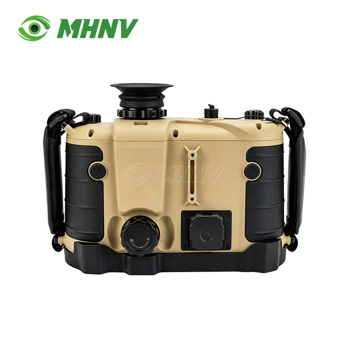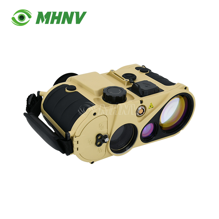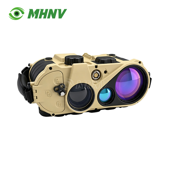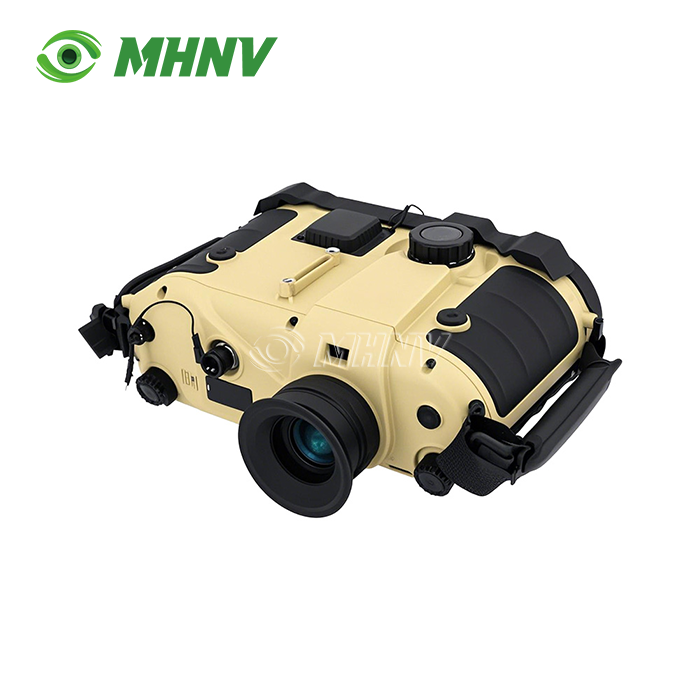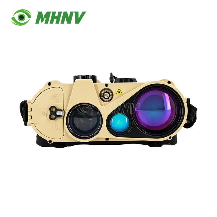
Laser Range Finder Binoculars
High-Performance Laser Range Finder Binoculars – Ultra-Long Range Professional Observation Solution with 23km Targeting Capability
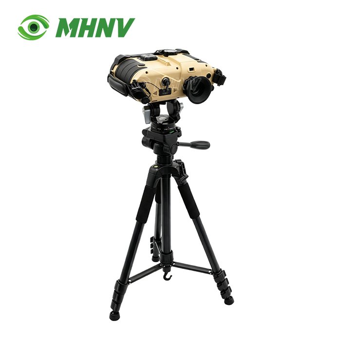
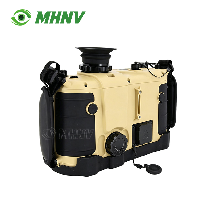
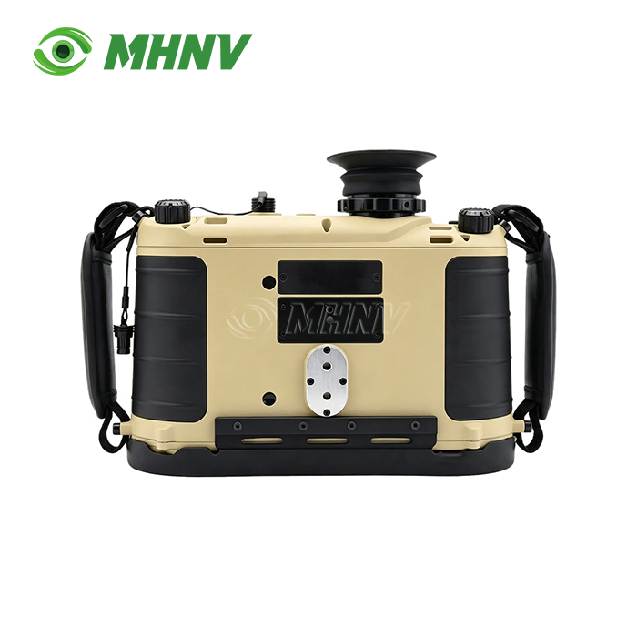
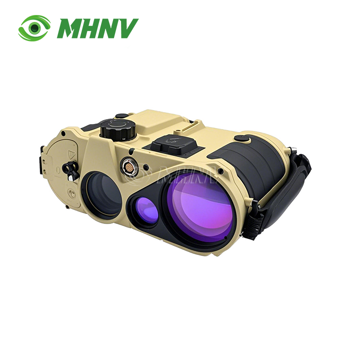
MHNV® MH-OL20 Laser Range Finder Binoculars deliver professional-grade ultra-long-range target acquisition in a compact 732g handheld platform. Featuring Class 1 eye-safe 1535nm laser technology with 23km building detection and 9km vehicle ranging, this system integrates 7× direct-view optics, sub-mil compass accuracy (0.06° azimuth after map correction), ±3m self-positioning precision, and integrated ballistic computing—all in a rugged IP67-sealed body operating continuously for over 10 hours. Designed for coastal surveillance, border observation, artillery spotting, and industrial infrastructure inspection, these products combine tripod-system performance with patrol-pouch portability across -40°C to +60°C environments.
Ultra-Long Range Eye-Safe Laser Technology
The MH-OL20 employs advanced 1535nm wavelength laser rangefinding that achieves measurement distances typically reserved for tripod-mounted systems.
With a maximum building detection range exceeding 23km and vehicle detection beyond 9km, the Class 1 eye-safe laser enables continuous ranging across populated areas and reflective coastal surfaces without ocular hazard warnings. The 50m minimum ranging capability ensures full-spectrum utility from extreme distance down to close observation.
Unlike consumer-grade units limited to 3–5km, this professional-grade system maintains accurate returns through atmospheric haze via multi-pulse integration and advanced DSP algorithms. The beam divergence remains below 0.5mrad, ensuring the laser spot remains target-specific rather than averaging surrounding landscape features at extreme distances.

Precision Navigation and Targeting Suite
Field-proven positioning accuracy defines operational reliability. The integrated digital magnetic compass delivers 0.3° (5 mil) field azimuth and refines to 0.06° (1 mil) after map correction, while pitch and roll accuracy remains within 0.1° (2 mil).
Self-positioning accuracy stays within ±3m, and target positioning maintains ≤20m circular error probable at operational distances. This sub-mil accuracy stack translates to reliable grid call-out at 20km range, meeting first-round artillery correction requirements and drone strike coordination standards.
Multi-target capability locks two separate targets simultaneously, calculating exact separation for convoy spacing analysis and artillery fall-of-shot measurement at ultra-long range.
Direct-View Optical Backup System
The 7× ±0.3× direct-view optical channel operates independently of electronic systems, providing zero-latency visual observation and reticle-based rough ranging even during total power failure or electronic warfare conditions.
This dual-mode architecture ensures mission continuity when fully-digital systems lose capability. Operators retain optical observation functionality that consumer-grade digital rangefinders sacrifice entirely when batteries drain, protecting mission-critical observation capability during extended deployments.
Integrated Ballistic Computing and Data Output
The onboard ballistic calculator accepts real-time meteorological input and custom munition parameters, generating firing solutions instantly.
RS232 full-data interface streams compass readings, range measurements, GPS coordinates, target grids, and ballistic solutions directly into command laptops, drone ground stations, and battle-management systems. This eliminates manual voice call-out and paper transcription, reducing observation-to-fire-mission timelines from minutes to seconds.
The scalable digital image output supports documentation and remote monitoring applications, while map positioning correction functionality compensates for magnetic declination variations across operational theaters.
Technical Specifications
| Parameter | Specification |
|---|---|
| Model | MHNV MH-OL20 |
| Optical Magnification | 7× ±0.3× direct-view |
| Laser Wavelength | 1535nm (eye-safe) |
| Laser Classification | Class 1 |
| Range (Building) | ≥23km |
| Range (Vehicle) | ≥9km |
| Minimum Range | 50m |
| Azimuth Accuracy | ≤0.3° (5 mil) field |
| Azimuth (Corrected) | ≤0.06° (1 mil) |
| Pitch/Roll Accuracy | ≤0.1° (2 mil) |
| Self-Position Accuracy | ±3m |
| Target Position Accuracy | ≤20m |
| Multi-Target Function | Supported |
| Ballistic Calculator | Integrated with meteorological input |
| Data Interface | RS232 full transmission |
| Dimensions | 190×240×100mm |
| Weight | 732g |
| Runtime | ≥10 hours continuous |
| Operating Temperature | -40°C to +60°C |
| Ingress Protection | IP67 |
Ruggedized All-Climate Design
The MH-OL20 is built to survive the roughest of operating conditions. With an IP67 rating, the MH-OL20 is completely submersible and dust-proof.
The operational envelope (-40°C to +60°C) includes arctic border patrol, desert armour observation, tropical littoral surveillance and coastal salt-spray situations with no performance derating at 100°C. Magnesium alloy chassis for thermal stability and structural integrity under field stress Multi-coated HD optics for clarity at temperature extremes.
An internal housing that is nitrogen purged minimises fogging and moisture build-up during fast temperature changes. Reliability is high across climate zones for the entire fleet, eliminating the operational cost of maintaining parallel device inventories for different environmental conditions.
Extended Mission Endurance
The internal power mechanism of the Laser Range Finder Binoculars can operate continuously for more than 10 hours on a single charge, allowing entire eight-hour shifts with capacity to spare.
This increased duration means there is no need for battery swaps mid-mission during coastal watch rotations, border surveillance shifts or artillery observation missions. In addition to the zero-power direct-view optical backup, operators retain observation capabilities over multi-day deployments without external power.
Professional Applications and Use Cases
Infrastructure Inspection: Engineers use the 23km range to monitor power line sag and pylon spacing across steep terrain where physical access is impractical, surveying whole transmission corridors from valley positions.
Coastal Surveillance: Maritime security teams use the Class 1 eye-safe laser over reflective sea surfaces to monitor shipping channels and detect cross border movement. Accurate target grids enable rapid reaction coordination.
Artillery Observation: Forward observers to sub-20m target positions to 15km+, aiding indirect fire correction with first-round accuracy removing ranging bracketing and ammunition waste.
Border Security: Patrol teams watch vehicle convoys and human movement across long sight lines, employing multi-target separation measurement to establish threat profiles without physical interception.
Industrial Survey: Our surveyors carry out extensive topographical mapping and GIS data acquisition along valleys and infrastructure corridors. Our surveyors collect precise spatial data without disturbing ecosystems.

FAQ
Q: How do these products maintain accuracy through atmospheric haze at maximum range?
A: The products utilize multi-pulse integration technology combined with advanced digital signal processing algorithms to filter atmospheric backscatter and lock onto true target returns even in degraded visibility conditions. The 1535nm wavelength experiences less Rayleigh scattering than shorter wavelengths, improving signal penetration through fog and coastal spray. The system averages multiple pulse returns to distinguish solid target reflections from atmospheric noise, maintaining measurement reliability beyond 20km when line-of-sight exists. For critical long-range operations, positioning the observer at elevated terrain above ground-level haze layers further enhances maximum effective range.
Q: Can the direct-view optical channel provide accurate ranging when electronics fail?
A: Yes, the 7× direct-view optical system incorporates a calibrated reticle for manual range estimation based on known target dimensions and angular measurements. While electronic laser ranging delivers sub-meter precision, the optical reticle enables trained observers to estimate ranges within 5–10% accuracy using mil-dot bracketing techniques—sufficient for initial observation and tactical decision-making when electronic systems are unavailable. This backup capability ensures operational continuity during battery depletion, electronic warfare interference, or component failure scenarios that render fully-digital systems completely inoperative.
Q: What maintenance procedures ensure long-term compass and ranging accuracy?
A: Digital compass calibration should be performed whenever the unit is deployed to a new geographical region with different magnetic declination values or after exposure to strong magnetic fields from vehicles, electrical equipment, or structural steel. Range calibration verification against known-distance targets should occur quarterly or after any physical shock events. External optical surfaces require periodic cleaning with lens-grade microfiber materials to prevent beam dispersion from contaminants. The nitrogen-purged housing requires no user maintenance but should be factory-serviced if internal fogging appears after severe temperature cycling, indicating seal compromise.
Q: How does the RS232 data interface integrate with existing command-and-control systems?
A: The RS232 full-data output streams ASCII-formatted strings containing timestamp, GPS coordinates, laser range, compass azimuth, pitch angle, target grid, and ballistic solution at configurable intervals. This standardized output connects directly to legacy command systems, modern battle-management laptops, and drone ground control stations using readily-available serial-to-USB adapters. Custom parsing scripts can extract specific data fields for integration into proprietary software platforms, while the human-readable ASCII format allows immediate verification using standard terminal programs during field setup and troubleshooting.
Q: What differentiates Class 1 eye-safe lasers from lower-class systems in operational use?
A: Class 1 eye-safe designation (1535nm wavelength) permits unrestricted operation around friendly personnel, civilian populations, and reflective surfaces without mandatory eyewear or range exclusion zones. Lower-class visible or near-infrared lasers (905nm, 1064nm) require controlled firing protocols and can trigger ocular injury warnings when beams intersect observation lanes. The 1535nm wavelength remains invisible to standard night vision devices, preventing detection by adversary observation systems. In coastal and urban environments with high personnel density and reflective glass or water surfaces, Class 1 certification eliminates operational restrictions that constrain tactical deployment of higher-class laser rangefinders.

Contact Us
Ready to deploy ultra-long-range precision observation? Contact MHNV® at sarah@mh-elec.com to discuss Laser Range Finder Binoculars custom configurations and delivery options for your operational requirements.
YOU MAY LIKE