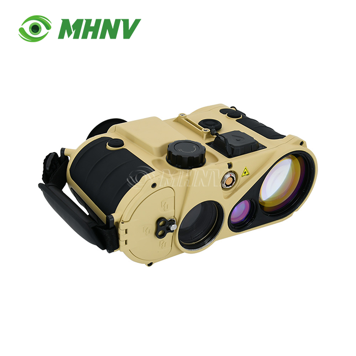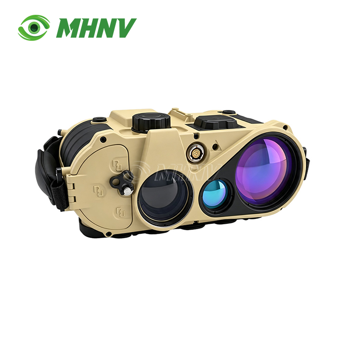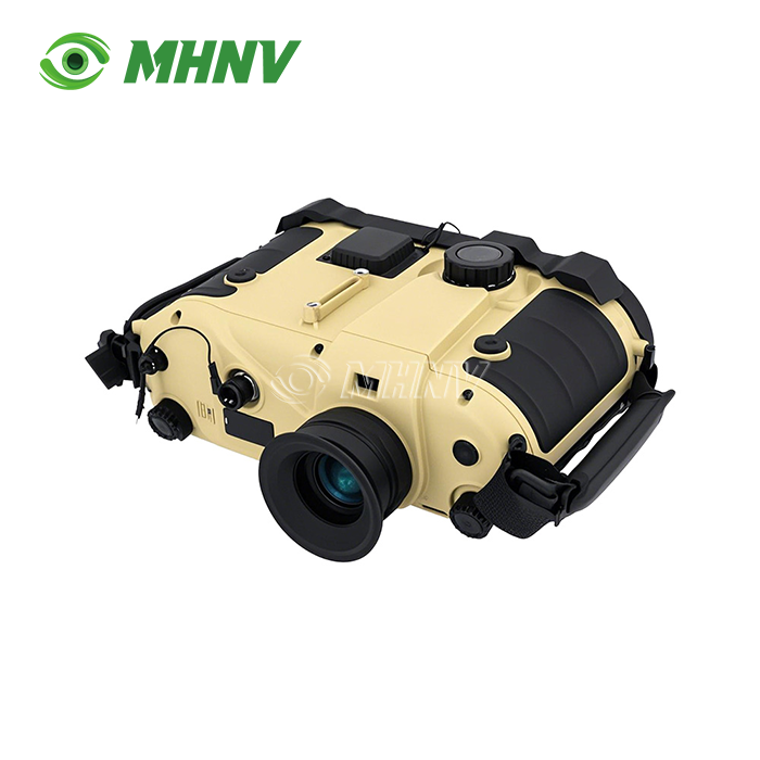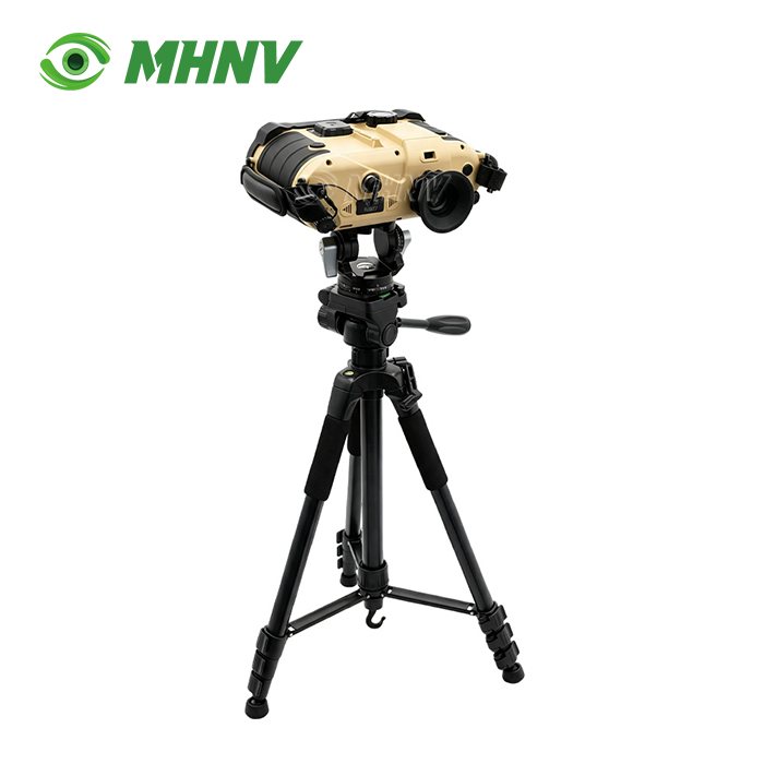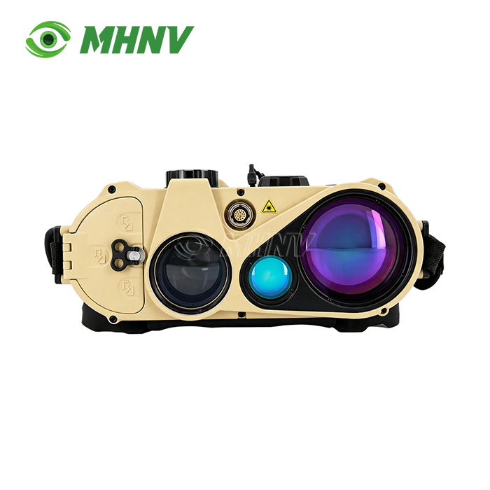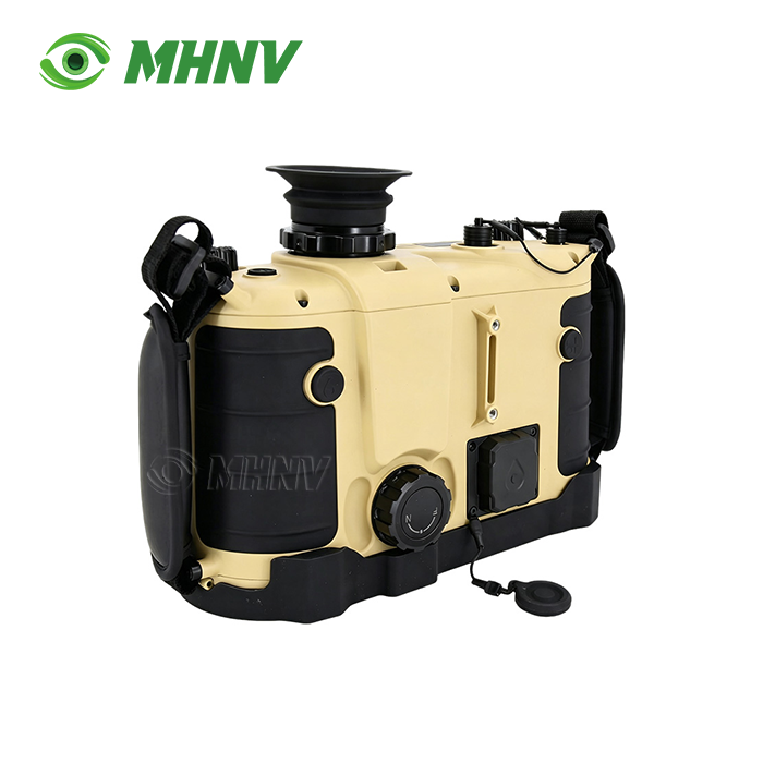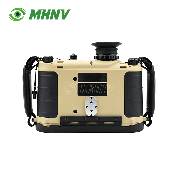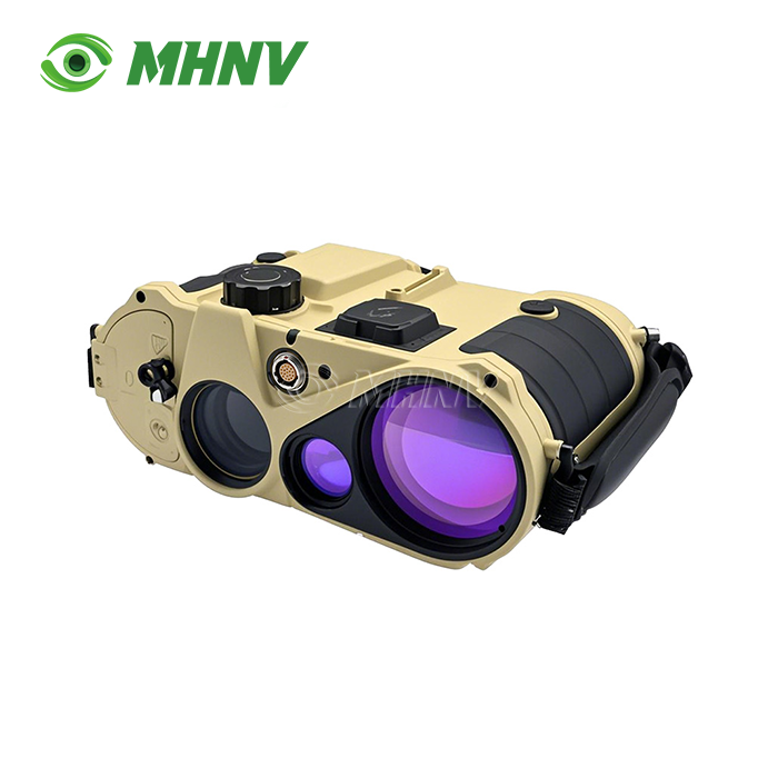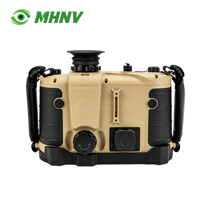
Digital Rangefinder Binoculars
High-Performance Digital Rangefinder Binoculars for Ultra-Long-Range Professional Observation and Target Location
Xi'an MH Electronics And Technology Co., Ltd. presents the MHNV MH-OL20 Digital Rangefinder Binoculars, a handheld ultra-long-range targeting system engineered for professional operators requiring precision measurement beyond 20 kilometers. The 732-gram, small device features 7× direct view optics and a Class 1 eye safe 1535nm laser rangefinder with a range of 23km on structures and 9km on cars. The built-in compass is accurate to 0.06° (1 mil) after map calibration and offers ±3m positioning accuracy and ≤20m target positioning accuracy with GNSS. It runs continuously for over 10 hours at temperatures between −40 °C and +60 °C in an IP67 sealed housing of just 190 × 240 x 100 mm.

What Makes Professional Digital Rangefinder Binoculars Essential for Long-Range Observation?
Professional-grade systems combine powerful semiconductor laser measuring with high-magnification optics and can achieve sub-meter precision at distances where traditional devices are not able to. These instruments use Time-of-Flight measuring algorithms combined with advanced angle sensors. Grid based systems include real-time ballistic computers, RS232 data streams and multi-target tracking, and are not restricted to the 3-5 mil azimuth accuracy of consumer devices.
The MH-OL20 MHNV solves three operating problems. First, most handheld rangefinders sacrifice range for weight. Tripod-mounted 3-5kg systems dominate the ultra-long-range market. Secondly, digital-only devices don’t work if the power goes out. Third, the sensor suite needed to coordinate indirect fires is not present on most rangefinders. Our design offers 23km reach in a sub-kilogram compact, zero-latency 7× direct-view backup optics, and complete targeting solutions with corrected azimuth, pitch, roll and ballistic drop.
Technical Specifications
| Parameter | Specification |
|---|---|
| Model | MHNV MH-OL20 |
| Architecture | Handheld direct-view binocular ultra-long-range system |
| Optical Magnification | 7× ±0.3× |
| Laser Wavelength | 1535 nm eye-safe |
| Laser Class | Class 1 eye-safe |
| Max Range (Building) | ≥23 km |
| Max Range (Vehicle) | ≥9 km |
| Minimum Range | 50 m |
| Azimuth Accuracy | ≤0.3° (5 mil) |
| Azimuth After Map Correction | ≤0.06° (1 mil) |
| Pitch/Roll Accuracy | ≤0.1° (2 mil) |
| Self-Positioning | ±3 m |
| Target Positioning | ≤20 m |
| Multi-Target Mode | Supported |
| Ballistic Calculator | Supported with real-time meteorological input |
| Data Interface | RS232 full data transmission |
| Dimensions | 190 × 240 × 100 mm |
| Weight | 732 g |
| Continuous Runtime | ≥10 hours |
| Operating Temperature | −40°C to +60°C |
| IP Rating | IP67 |
Core Performance Advantages for Demanding Operational Environments
Ultra-Long Reach in Handheld Form Factor
The 23km building and 9km vehicle laser capability resides in a 732-gram body. Coastal watch teams monitoring shipping lanes measure vessel distances without deploying tripod systems. Border observers track cross-border movement from concealed positions where weight matters. Artillery forward observers maintain continuous observation through multi-hour missions without fatigue from heavy optics.
Eye-Safe Operation with Direct-View Backup
The 1535nm Class 1 eye-safe laser allows continuous ranging across populated areas and reflective coastal surfaces without ocular hazard protocols. When electronics fail or batteries drain, the 7× direct-view optical channel continues functioning. You retain visual observation and reticle-based rough range estimation during electronic warfare or power failure—capability that fully-digital systems lose entirely.
Sub-Mil Accuracy for Grid-Based Fire Control
Azimuth accuracy of 0.06° (1 mil) after map correction, combined with 0.1° (2 mil) pitch and roll measurement, delivers under 20-meter circular error probable on target grids at 15km range. This precision supports first-round artillery correction and drone strike coordination. Consumer-grade devices stop at 3-5 mil azimuth accuracy, losing utility for indirect fire control beyond 3km and forcing operators to escalate to heavier tripod-mounted systems.
Extended Runtime with Command-Post Integration
No less than 10 hours continuous operation on internal power supports full 8-hour observation shifts with reserve. The RS232 interface streams compass, range, GPS, target grid, and ballistic solutions directly into command laptops, drone ground stations, and battle-management systems. Headquarters receives real-time targeting data without manual voice transcription, cutting the observation-to-fire-mission timeline from minutes to seconds.
All-Climate Rugged Design
Digital Rangefinder Binoculars IP67 sealing and a −40°C to +60°C operating envelope cover arctic border patrol, desert armor observation, tropical surveillance, and coastal salt-spray environments without derating. The same device handles every climate zone your operations span, eliminating the parallel-fleet cost of climate-specific variants.
Advanced Feature Integration for Professional Workflows
Multi-Target Relative Distance Measurement
Lock two targets simultaneously and read exact separation distance. Artillery observers measure fall-of-shot error against target position. Convoy-monitoring teams measure vehicle spacing at ultra-long range. This dual-target mode eliminates sequential measurement delays and the positional drift errors that accumulate when measuring targets separately.
Ballistic Computer with Meteorological Input
Real-time environmental sensors feed temperature, barometric pressure, and humidity into the onboard ballistic calculator. Enter custom munition data for your specific ammunition. The system outputs holdover and windage corrections directly, removing manual calculation errors. The RS232 stream delivers this data to external systems for automated aiming solutions.
Map Positioning Correction
GNSS coordinates alone contain systematic errors in certain terrain. The map-correction function allows you to input surveyed reference points, refining azimuth accuracy from 0.3° to 0.06°. This calibration step transforms raw sensor data into grid-quality measurements suitable for artillery fire missions and geospatial intelligence databases.

Quality Assurance and Manufacturing Excellence
Every MHNV MH-OL20 unit undergoes rigorous verification at our Xi'an facility. Optical axis collimation ensures the laser emitter, receiver, and viewing path align perfectly. Range calibration against NIST-traceable baselines certifies digital readouts match physical distance within specified tolerances. Thermal cycling from −40°C to +60°C and vibration testing simulate harsh transport and operational conditions.
Our ISO 9001:2015 quality management system governs production from component selection through final testing. Salt-spray testing validates maritime longevity. Each device ships with a serialized QC data sheet documenting measured performance parameters. CE, RoHS, and FCC compliance ensure regulatory acceptance across global markets.

Applications Across Professional Sectors
Maritime Navigation and Coastal Surveillance: Measure vessel distances through sea spray and fog using Last Target logic that filters interference. Superior light-gathering optics maintain target visibility in low-light dawn and dusk patrol windows.
Infrastructure and Power Engineering: Technicians measure wire-clearance distances and sag analysis in complex urban corridors where traditional tape methods fail. The vertical angle sensor enables accurate point-to-point calculations without direct access to measurement points.
Long-Range Observation and Reconnaissance: Border security teams track movement across valleys and ridges from concealed observation posts. The lightweight design supports covert positioning where heavier tripod systems compromise concealment.
Search and Rescue Coordination: Rapidly measure distances to distressed persons or hazards across difficult terrain. GPS coordinates stream to rescue command centers, enabling precise helicopter navigation and resource deployment.
FAQ
Q: How does the 1535nm wavelength provide longer range than common 905nm rangefinders?
A: The 1535nm wavelength offers superior atmospheric transmission characteristics compared to 905nm, especially through humidity, light fog, and haze conditions common in coastal and tropical environments. This wavelength experiences lower Rayleigh scattering, allowing the laser pulse to maintain coherence over extended distances. Additionally, 1535nm systems achieve Class 1 eye-safety at higher power levels than 905nm, enabling stronger outgoing pulses that reflect sufficient energy from distant low-reflectivity targets. The combination of better atmospheric penetration and higher permissible power delivers the 23km building and 9km vehicle performance you see in the MH-OL20.
Q: What is the practical difference between self-positioning accuracy and target-positioning accuracy?
A: Self-positioning accuracy of ±3 meters describes how precisely the device determines your current GPS coordinates—critical when you need to report your own location or navigate to a specific observation point. Target-positioning accuracy of ≤20 meters describes the combined error when calculating a distant target's GPS coordinates from your position, range measurement, azimuth, and elevation angle. The target error is larger because it accumulates your positional uncertainty, the laser range error, compass error, and angle-measurement error. For artillery fire missions at 15km range, 20-meter target accuracy places the calculated grid within effective-radius-of-burst for most indirect-fire systems.
Q: Can the direct-view optical channel function independently when the electronics are powered off?
A: Yes, the 7× direct-view binocular channel operates entirely independent of electronic power. You retain full magnified observation and can use the optical reticle for rough range estimation based on known target dimensions. This passive capability ensures continuous observation during battery exhaustion, electronic warfare jamming, or component failure—situations where fully-digital rangefinder systems become completely non-functional. The direct-view backup transforms the MH-OL20 from a powered instrument into a conventional binocular, preserving your mission-essential observation capability.
Q: How does multi-target mode improve artillery fire correction compared to sequential measurement?
A: Traditional sequential measurement requires you to range the target, record the data, then range the artillery impact, and manually calculate the separation—during which time atmospheric conditions may shift or your hand position may drift. Multi-target mode locks both points simultaneously and calculates the exact separation vector including bearing and distance differences. This eliminates time-lag errors and provides immediate correction data. For long-range artillery where rounds may land 100+ meters from aim point, the precise separation measurement enables first-round correction rather than iterative bracketing, conserving expensive ammunition and reducing time-to-effect.
Q: What maintenance procedures are required to preserve accuracy in harsh environments?
A: The IP67-sealed housing protects internal components from dust and immersion, minimizing maintenance requirements. After exposure to salt spray or dusty conditions, wipe external lens surfaces with a microfiber cloth and non-abrasive lens cleaner. Avoid solvents on rubber armor or the display window. Store the device in the supplied protective case when not in use. Periodic recalibration is recommended after severe shock events or every 12-24 months in high-use scenarios. MHNV provides remote calibration-verification procedures and can arrange factory recalibration services for units requiring NIST-traceable certification updates.

Partner with MHNV for Advanced Optoelectronic Solutions
Contact our engineering team at sarah@mh-elec.com to discuss your specific Digital Rangefinder Binoculars operational requirements and customization options.
YOU MAY LIKE