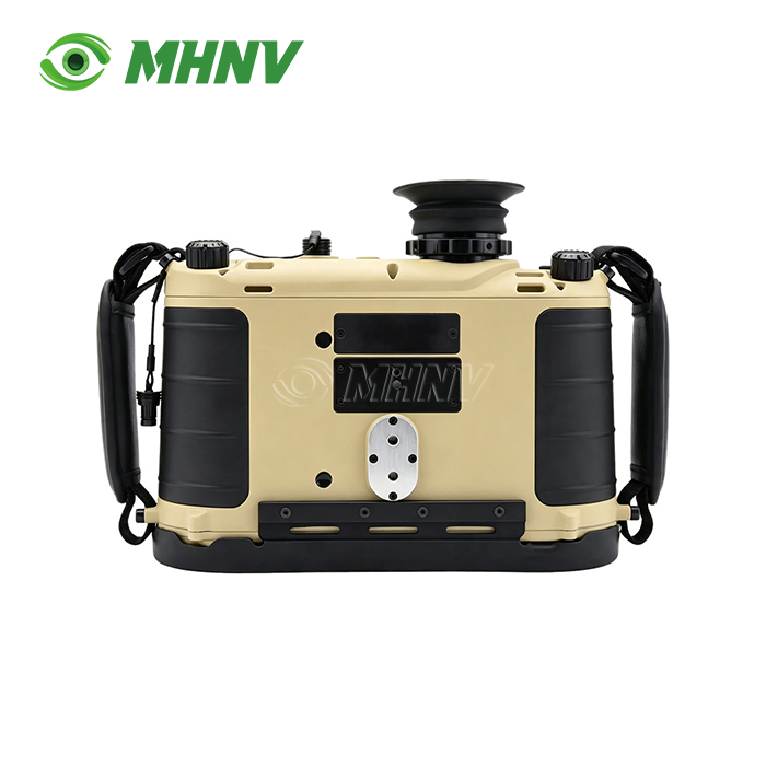
High Precision Laser Rangefinder Binoculars
High Precision Laser Rangefinder Binoculars | 23km Ultra-Long Range Target Acquisition System with Sub-Mil Grid Accuracy
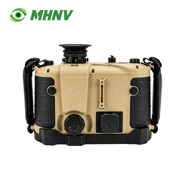
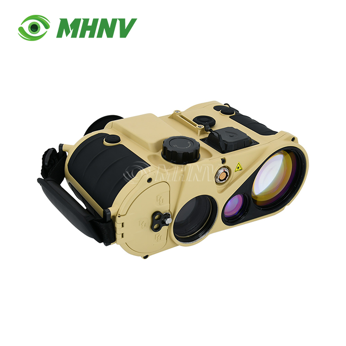
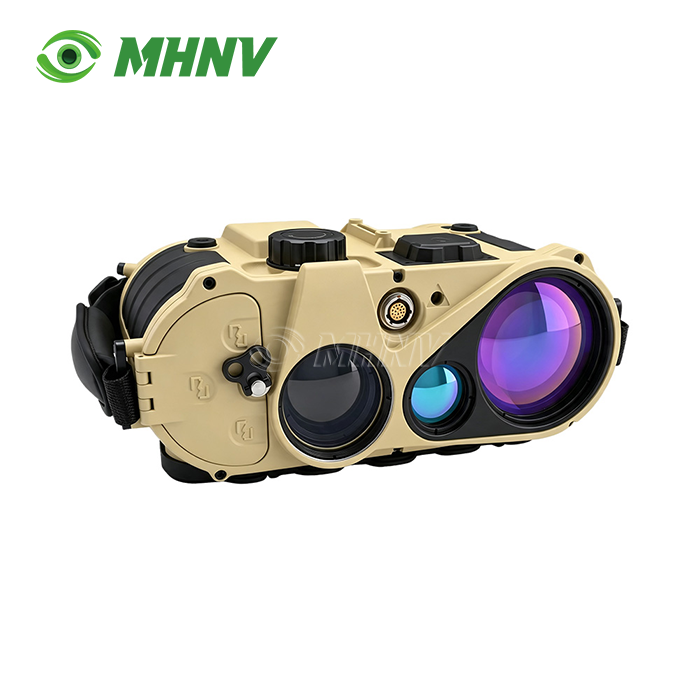
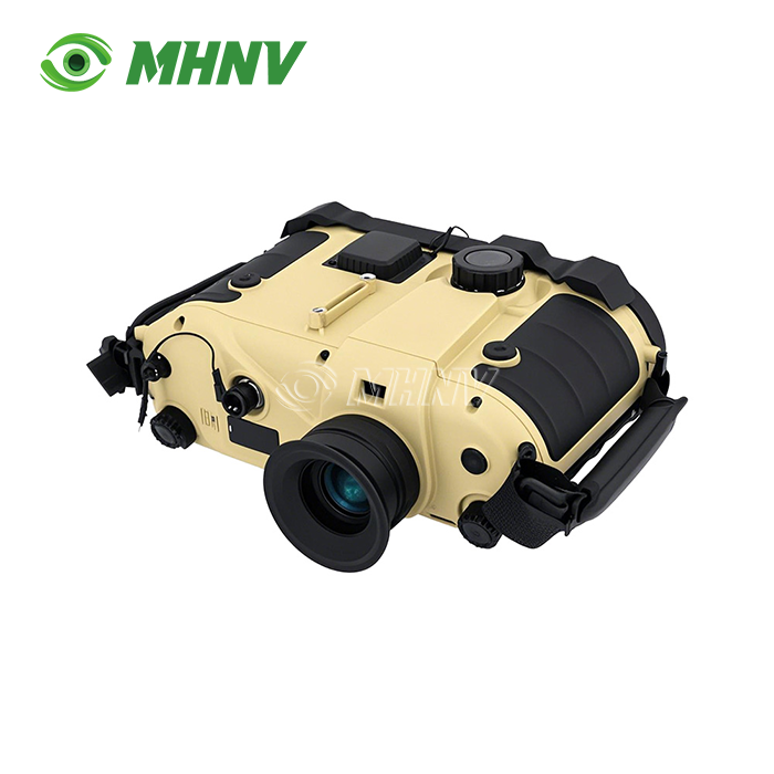
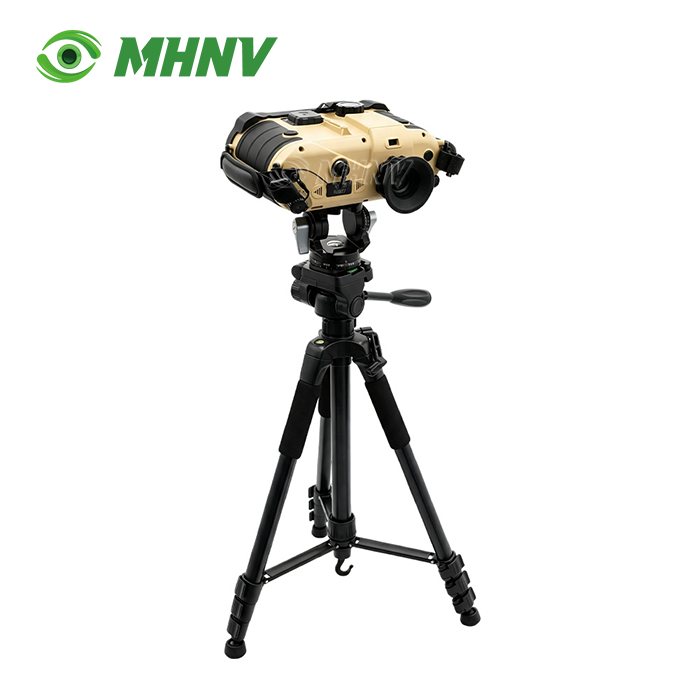
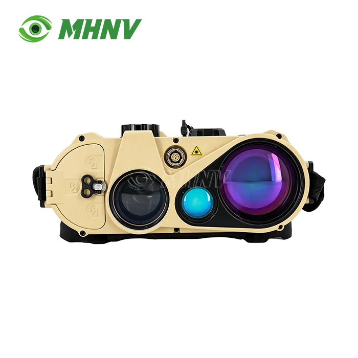
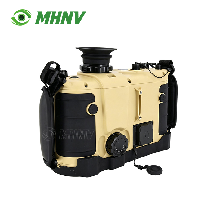
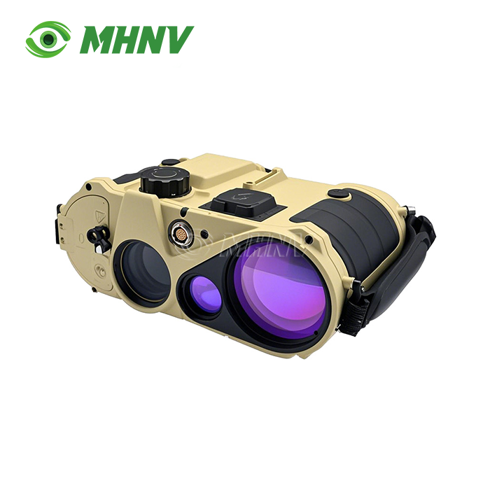
High Precision Laser Rangefinder Binoculars represent advanced optoelectronic instruments combining direct-view optics with laser distance measurement for professional observation applications. The MHNV® MH-OL20 delivers 23km building ranging and 9km vehicle detection in a 732g handheld package, featuring 7×±0.3× magnification, 1535nm Class 1 eye-safe laser, and 0.06° azimuth accuracy after map correction. This enterprise-grade system integrates electronic compass (0.3° field azimuth), dual-target lock capability, ballistic calculator with real-time meteorological input, and ≥10-hour continuous runtime. Operating across −40°C to +60°C with IP67 sealing, it provides sub-20m target positioning accuracy at extended ranges while maintaining zero-latency optical backup during power loss.
Why Professional Teams Choose Ultra-Long Range Observation Systems?
Ordinary optical binoculars are not capable of advanced observation. Teams that monitor the coast and track vessel movements beyond 15km need exact grid coordinates, not rough bearings.
Indirect fire observers need sub-mil angular accuracy to convert azimuth readings into usable target data. Units for border monitoring in harsh climates require sealed housings that can operate in arctic cold or desert heat. Infrastructure inspection teams measuring tower clearances and structural deflection need instantaneous vertical angle calculation without manual trigonometry.
Common needs of these situations are: long detection range, measurement accuracy to professional standards, environmental durability and capacity to integrate with command systems. Standard consumer rangefinders are limited to 1-3km with ±1m accuracy and lack the compass, tilt sensor and data output required for grid-based operations.
Technical Architecture of the MH-OL20 System
Dual-Channel Observation Design
The system consists of direct view 7 × optical binoculars and electrical range and orientation sensors. You keep visual link through traditional optics and measurement data are overlaid with laser, compass and GPS modules. If the battery is dead, or electronic countermeasures are interfering with the digital operations, the optical channel is still functional, with the reticle used as an estimation of range.
Eye Safe Long Range Laser Performance
The Class 1 1535nm laser has a range of 23km on high reflectivity targets such as building facades and a range of 9km on mid reflectivity vehicles. Range in minimum 50m The wavelength is below the ocular hazard thresholds and hence can be operated continuously in populous areas and in surveillance scenarios involving mixed friendly and hostile forces, without activating any safety procedures.
Precision Orientation Pack
The electronic compass provides 0.3° (5 mil) field azimuth accuracy. Map-positioning correction gives azimuth of 0.06o (1 mil). The pitch and roll sensors have an accuracy of 0.1° (2 mil). Combined with target range data, these parameters yield ≤20m circular error probability on target grids at operating distances, meeting first-round firing correction requirements.
Key Technical Specifications
| Parameter | Specification |
|---|---|
| Model | MHNV MH-OL20 |
| Optical Magnification | 7× ± 0.3× |
| Laser Wavelength | 1535 nm (Class 1 eye-safe) |
| Maximum Range (Building) | ≥ 23 km |
| Maximum Range (Vehicle) | ≥ 9 km |
| Minimum Range | 50 m |
| Azimuth Accuracy (Field) | ≤ 0.3° (5 mil) |
| Azimuth Accuracy (Corrected) | ≤ 0.06° (1 mil) |
| Pitch/Roll Accuracy | ≤ 0.1° (2 mil) |
| Self-Positioning Accuracy | ± 3 m |
| Target Positioning Accuracy | ≤ 20 m |
| Multi-Target Measurement | Supported (2 targets) |
| Ballistic Calculator | Integrated with meteorological input |
| Data Interface | RS232 full transmission |
| Dimensions | 190 × 240 × 100 mm |
| Weight | 732 g |
| Continuous Runtime | ≥ 10 hours |
| Operating Temperature | −40°C to +60°C |
| Ingress Protection | IP67 |
Multi-Target Lock and Separation Measurement
The device lets you lock on two different targets at once and provides accurate separation distance. This function is used by artillery observers to measure divergence of fall-of-shot from the target. Convoy tracking apps measure the distance between vehicles. Coastal surveillance teams identify clustering vessels. This dual-lock capability prevents the sequential measurement approach that leads to timing mistakes when targets or observation platforms are in motion.
Integrated Ballistic Calculator and Data Output
Onboard ballistic calculator is fed by real time weather sensors measuring atmospheric pressure, temperature and tilt. You input custom munition profiles, or choose from existing trajectories. The RS232 interface broadcasts range, azimuth, elevation, GPS coordinates and computed shooting solutions straight to command computers, drone ground stations or fire control systems. Scalable digital image output allows incorporation into battle-management networks, reducing observation-to-action timescales from minutes to seconds.
Operational Endurance and Environmental Sealing
High Precision Laser Rangefinder Binoculars Internal power supply, ≥10 hours continuous work without external battery packs. They do single-shift surveillance missions and multi-day forward deployments without recharging in between. The internal electronics are protected from dust ingress and temporary immersion by the IP67 cover. The operational environment from −40°C to +60°C includes arctic border patrol, desert armour observation and tropical littoral surveillance without performance derating or component failure.
Application Scenarios for High Precision Laser Rangefinder Binoculars
Maritime Navigation and Coastal Surveillance: At coastal observation posts, ship-watch teams measure vessel ranges beyond 15km and construct approach vectors using integrated compass data. The eye-safe laser can be operated continuously without ocular hazard constraints when scanning mixed commercial and patrol traffic.
Infrastructure Inspection and Power Engineering: Utility staff monitor sag on overhead transmission lines and check clearance distances on tall structures. The vertical angle sensor allows for immediate height determination without human trigonometry, making inspection operations more efficient and improving the precision of documentation.
Long-Range Observation and Target Acquisition: Forward observers supporting indirect fire missions acquire targets at extended distances and relay precise grid coordinates through RS232 data links. First round adjustment within engagement time frames to sub-mil angular precision.
Border Security and Perimeter Monitoring: Teams on the remote borders identify cross-border movement at extraordinary distances and determine precise positions for interception plans. Lightweight 732g design means no fatigue penalty for extended foot patrols.

Manufacturing Excellence Behind MHNV® Systems
Xi'an MH Electronics And Technology Co., Ltd. has comprehensive engineering and production facilities, including optical design, laser module integration, FPGA-based signal processing and environmental testing. MHNV® has been supplying nite vision, thermal imaging and laser rangefinder systems to customers in 60+ countries since 2013.
Precision optical assembly with Class 10,000 clean rooms. Rapid prototype and volume production with on-site PCB fab and SMT lines. Each unit is signal-to-noise tested, resolution checked, environmentally cycled and shock & vibration qualified before shipment. ISO 9001:2015 certification covers quality procedures. Global market access assured CE, RoHS, FCC compliant
OEM and ODM Customization Capabilities
MHNV® offers total product customisation from hardware, firmware and mechanical design layers. The platform is adapted to unique mission profiles by choosing laser wavelength, adjusting optical magnification, configuring data interface and selecting housing material. Custom firmware allows for multilingual user interfaces, proprietary data protocols, and integration into existing command systems. Branded packaging, user documentation and warranty plans facilitate complete private-label deployment.

FAQ
Q: What is the difference in effective range between building and vehicle targets for the products?
A: The products have larger ranges on high-reflectivity surfaces such as building facades (23km) than on mid-reflectivity vehicle bodies (9km) since the laser pulse return intensity relies on target surface properties, material composition and incident angle geometry. Buildings provide larger, flatter and frequently lighter coloured surfaces that reflect more pulse energy back to the receiver. Vehicles have smaller cross-sections, curved geometries and darker paint that absorbs or scatters laser radiation. Professional units like as the MH-OL20 employ sensitive avalanche photodiode receivers that increase detection of weak return signals, expanding vehicle ranging capacity beyond ordinary consumer devices.
Q: How does the map-positioning correction enhance azimuth accuracy of such systems?
A: Map-positioning correction uses known survey points or GPS coordinates to calibrate the internal electronic compass. This reduces field azimuth error from 0.3° (5 mil) to 0.06° (1 mil) by accounting for local magnetic declination, surrounding ferrous objects and sensor drift over time. The user identifies reference locations on a calibrated map, and the system produces correction factors that are applied to all subsequent azimuth readings. This procedure is critical to precise fire control and grid-based targeting, as uncorrected compass errors accumulate with distance into unacceptable target-location uncertainty at ranges greater than 10km.
Q: Is the direct view optical channel immune to electronics failure?
A: Yes, the direct-view 7x optical binoculars remain operational as conventional non-electronic optics in the event of battery drain or electronic system failure. They provide zero-latency visual observation and reticle-based rough range estimation, ensuring mission continuity in the event of power loss, sustained electronic warfare or component malfunction. This dual-channel architecture offers vital redundancy absent in fully-digital observation systems, ensuring you preserve situational awareness and approximate targeting capability even when laser rangefinder, compass, GPS and data output capabilities are lost.
Q: What operational advantages does the RS232 data interface provide?
A: The RS232 interface streams real-time range, azimuth, elevation, GPS coordinates, and ballistic solutions directly into command laptops, fire-control computers, drone ground stations, and battle-management networks without manual transcription, eliminating voice-relay errors and reducing observation-to-action timelines from minutes to seconds. Automated data transfer supports archive logging, mission replay analysis, and integration with geographic information systems, enabling command posts to visualize multiple observer feeds simultaneously and coordinate complex multi-asset operations with precise spatial awareness.
Q: How does IP67 sealing ensure reliability across extreme operating temperatures?
A: IP67 ingress protection prevents dust intrusion and withstands temporary immersion up to 1 meter depth for 30 minutes, while internal nitrogen purging eliminates moisture that would otherwise condense on optical surfaces during temperature cycling between −40°C and +60°C operating extremes. Sealed construction maintains optical clarity and electronic functionality across arctic cold, desert heat, tropical humidity, and coastal salt-spray environments without performance derating, internal fogging, or corrosion damage that degrades unsealed devices, ensuring consistent operational readiness across all deployment climates your organization encounters.
Contact MHNV® for Customized Observation Solutions
Contact our engineering team at sarah@mh-elec.com to discuss specifications, customization options, and volume pricing for High Precision Laser Rangefinder Binoculars for your next project.
YOU MAY LIKE