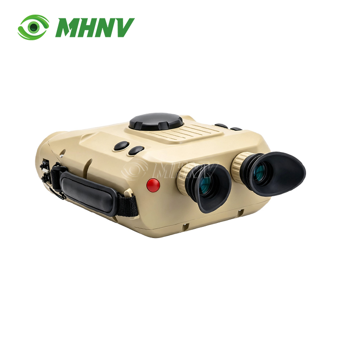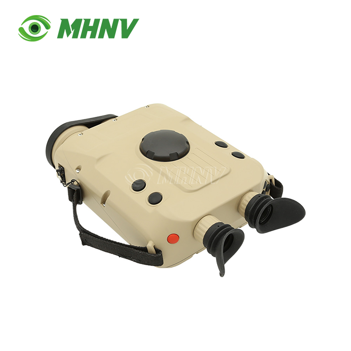
Handheld Thermal Binocular
Handheld Thermal Binocular with Cooled Sensor – Ultra-Long-Range Detection and Multi-Spectral Fusion Solution
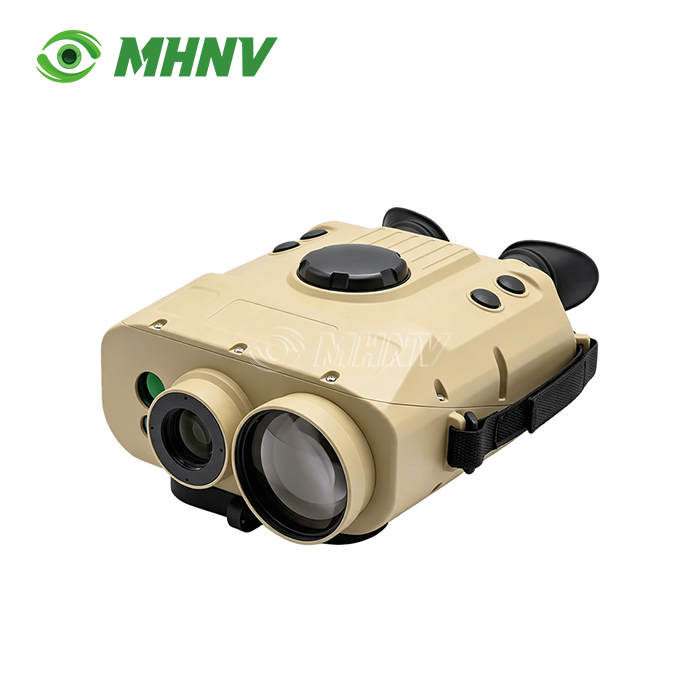
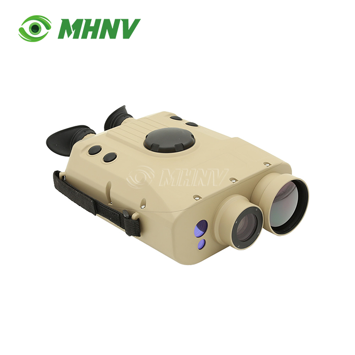
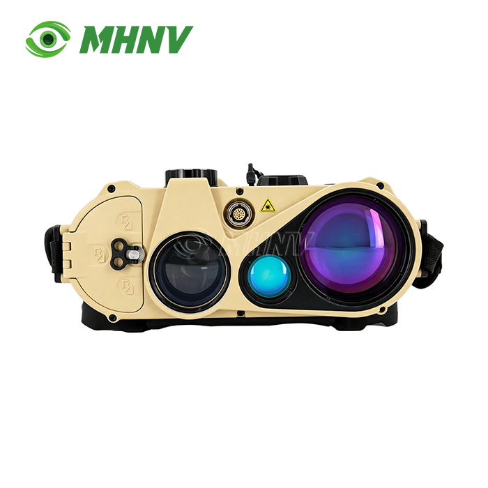
Thermal imaging solutions in professional-grade observation systems have evolved beyond uncooled detector technologies. Xi'an MH Electronics And Technology Co., Ltd. introduces an advanced Handheld Thermal Binocular built around a refrigerated infrared core capable of precise target identification beyond 10km. This dual-spectrum platform integrates a 640×512px cooled thermal sensor with continuous 15–300mm optical zoom, 1920×1080px visible-light imaging, and a 1535nm eye-safe laser rangefinder delivering ±2m accuracy at ranges exceeding 13km. The system includes BeiDou GNSS positioning with WGS84/CGCS2000 coordinate support, a 0.2° RMS azimuth compass, and modular expansion ports for laser designation, fulfilling enterprise-level requirements for long-distance surveillance, topographic reconnaissance, and real-time ballistic integration.
Why Cooled Infrared Detectors Redefine Long-Range Thermal Imaging?
Traditional uncooled microbolometer sensors face fundamental limits in sensitivity and detection range. Cooled detectors overcome these constraints through cryogenic stabilization, reducing thermal noise to near-theoretical minimums. In this product, the cooled sensor achieves medium-sized vehicle recognition at ≥10km and structural ranging at ≥13km—performance levels unattainable by standard handheld platforms.
Three switchable imaging modes address every operational scenario. Infrared polarity mode delivers high-contrast thermal signatures in complete darkness. Visible-light low-illumination mode captures contextual detail under starlight conditions. Multi-spectral fusion mode overlays thermal and visible data streams, enabling operators to correlate heat sources with structural features in real time. This flexibility eliminates the need to carry separate observation systems for diverse lighting environments.

Technical Specifications
| Parameter | Specification |
|---|---|
| Imaging Modes | Infrared polarity / Visible low-light / Multi-spectral fusion |
| Thermal Sensor | 640×512px cooled detector |
| Thermal Zoom | 15–300mm f/4.0 continuous optical zoom |
| Thermal FOV | 35.5°×28.7° (wide) to 1.83°×1.47° (tele) |
| Visible Sensor | 1920×1080px CMOS |
| Visible Zoom | Continuous optical zoom, FOV 35.5°×28.7° to 1.37°×1.10° |
| Laser Rangefinder | 1535nm eye-safe, range ≥10km (vehicles) / ≥13km (structures), accuracy ±2m |
| GNSS Positioning | BeiDou, output WGS84/CGCS2000/Gauss/UTM/MGRS |
| Electronic Compass | Azimuth accuracy 0.2° RMS, pitch/roll ≤0.1° RMS |
| Display | 0.71-inch OLED, 1920×1080px |
| Detection Range | Vehicle recognition ≥10km, structure ranging ≥13km |
| Operating Temperature | −40°C to +60°C |
| Ingress Protection | IP67 |
| Battery Life | ≥5 hours continuous operation |

Continuous Optical Zoom Without Resolution Loss
Many zoom-equipped observation systems rely on digital magnification, which degrades image quality at higher zoom factors. This product employs true continuous optical zoom across its entire 15–300mm focal range. Both thermal and visible channels maintain full 1920×1080px resolution from maximum wide-angle to maximum telephoto settings. Operators transition seamlessly between wide-area scanning and detailed target examination without sacrificing pixel density or introducing interpolation artifacts.
The fusion algorithm synchronizes thermal and visible zoom positions, ensuring overlay accuracy throughout the zoom range. This lossless zoom capability preserves fine target details essential for long-range identification tasks.
Integrated Laser Ranging and Precision Navigation
Accurate distance and position data transform observation platforms into actionable intelligence systems. The built-in 1535nm laser rangefinder reaches ≥10km on vehicle-sized targets and ≥13km on structural features, with measurement accuracy of ±2m. The longer wavelength falls within the eye-safe spectrum, eliminating operational hazards associated with shorter-wavelength lasers.
BeiDou GNSS receiver outputs target coordinates in multiple geodetic and projected formats: WGS84, CGCS2000, Gauss-Krüger, UTM, and MGRS. The high-precision electronic compass delivers azimuth readings with 0.2° RMS accuracy and pitch/roll measurements within 0.1° RMS. Combined, these subsystems enable rapid target coordinate extraction for command centers, mapping systems, and trajectory calculation software.
Automatic Target Detection and Field Ruggedization
Extended surveillance operations demand automation to reduce operator fatigue. The Handheld Thermal Binocular includes onboard target detection algorithms that highlight suspicious human signatures within the thermal image. This feature accelerates threat identification during large-area scans and maintains operator alertness over multi-hour missions.
Physical construction meets demanding field requirements. IP67-rated enclosure protects internal electronics from dust ingress and temporary water submersion. Operating temperature range spans −40°C to +60°C, covering arctic and desert deployment scenarios. Battery life exceeds five hours of continuous operation, supported by swappable power cells for indefinite field endurance.
Application Scenarios
Border and Perimeter Security: Security personnel leverage the cooled sensor's extended detection range to identify intrusions at distances beyond patrol response times. Multi-spectral fusion has a lower false-alarm rate and can better discriminate animal activity and human movement. Coordinate output is tied directly into command-and-control mapping systems for real-time situational awareness.
Search and Rescue Operations: SAR teams rely on the binocular to find heat signatures in deep woodlands, steep terrain or catastrophe zones that are out of reach of visible-light systems. The laser rangefinder gives accurate distances for organising helicopter extractions, while the GNSS coordinates provide accurate geolocation of survivors for ground troops.
Infrastructure Inspection: Operators in the energy sector inspect transmission cables, pipelines and solar systems at safe standoff distances. The ongoing zoom shows thermal anomalies suggestive of component failures, with visible channel detail providing structural context. Rangefinder data allows for mapping of defects into asset-management databases.
Maritime Surveillance: Coastal monitoring stations employ the method to identify vessel heat signatures via sea spray and fog. IP67 protection withstands the severe saltwater environment and the cooled sensor retains sensitivity despite humidity and temperature changes common to the nautical environment.

FAQ
Q: What detection range advantage does a cooled thermal sensor provide compared to uncooled systems?
A: Cooled infrared detectors are provided with cryogenic stabilisation that reduces the thermal noise, providing sensitivity levels some times greater than uncooled microbolometers, which allows this device to detect medium-sized cars over 10 kilometres and structures over 13 kilometres. Lower signal to noise ratios mean uncooled sensors often have feasible detection of similar objects at 2-3km. The increased sensitivity of the cooled detector also increases visual contrast in high temperature situations when the uncooled sensors are limited by the surrounding thermal noise.
Q: What are the advantages of multi-spectral fusion in target identification over single spectrum imaging?
A: Multi-spectral fusion combines thermal infrared data with visible-light imagery in real time, allowing operators to connect heat signatures with physical structures, terrain features and contextual elements that thermal-only photography cannot disclose. The binocular’s fusion algorithm maintains pixel level alignment for accurate overlay by synchronising the 640×512px thermal channel and the 1920×1080px visible channel across the whole optical zoom range. This means faster target categorisation and less uncertainty when differentiating similar thermal profiles such as automobiles against natural heat sources.
Q: Will the coordinate output work with third party mapping and command software?
A: Yes, the BeiDou GNSS receiver provides position data in WGS84, CGCS2000, Gauss-Krüger, UTM and MGRS coordinate formats. These are industry standard geodetic systems that are interoperable with GIS platforms, tactical mapping applications and command-and-control networks. The derived target coordinates are accurate to 0.2° of azimuth, and the laser ranging precision is ±2m, which is sufficient for most operational mapping procedures. Serial and network interfaces are supported in direct data feed export protocols.
Q: How much battery life do operators expect with extended field deployments?
A: More than five hours of continuous operation on one battery charge. The cryogenic system of the cooled detector is optimised for power efficiency. Battery cells are field-replaceable, enabling for unlimited operation if spare packs are carried. Power consumption depends on zoom position, display brightness and laser usage, thus typical field settings of alternating between standby and active observation extend practical runtime beyond the five hour continuous rating.
Q: Can the OEM be adapted to become part of larger surveillance systems?
A: MHNV® offers full OEM and ODM services including firmware customisation for user interface localisation, data output protocol change and mechanical housing redesign to meet customer branding or mounting needs. Custom ballistic profiles can enhance range finding applications, while available laser identification modules provide capability for guided system integration. Minimum order quantities and lead times are adjustable on a project basis, please call our engineering team to discuss your individual requirements.
Partner with MHNV® for Tailored Thermal Solutions
Our vertically integrated production facility ensures quality control from sensor calibration to final testing. For technical inquiries or custom Handheld Thermal Binocular project discussions, reach our team at sarah@mh-elec.com.
YOU MAY LIKE
.webp "Laser Target Locator Module (LTLM)")