.webp)
Laser Target Locator Module (LTLM)
High-Precision Laser Target Locator Module (LTLM) | 10km Eye-Safe Ranging & Sub-Mil Accuracy for Professional Surveillance & Reconnaissance
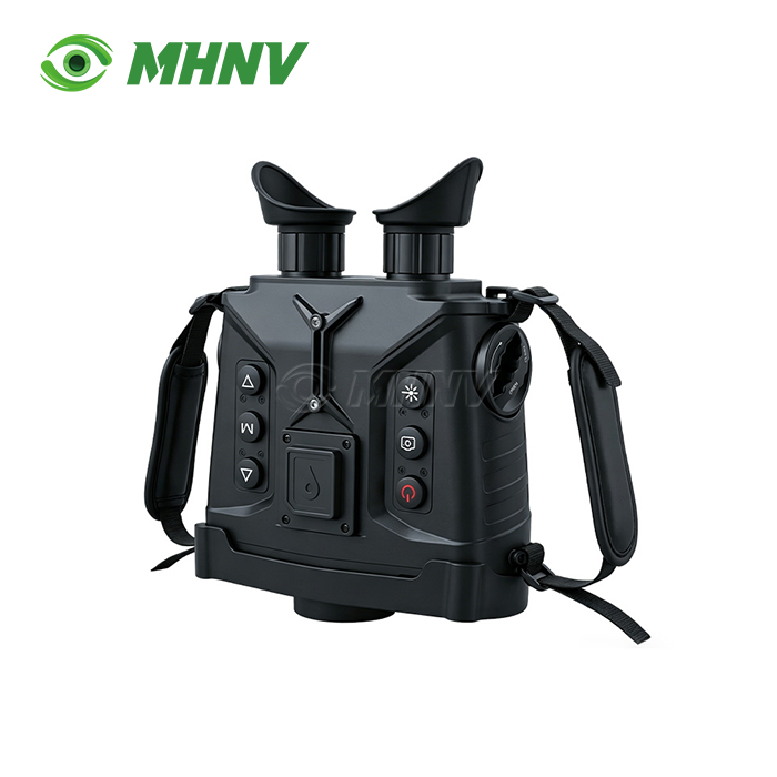
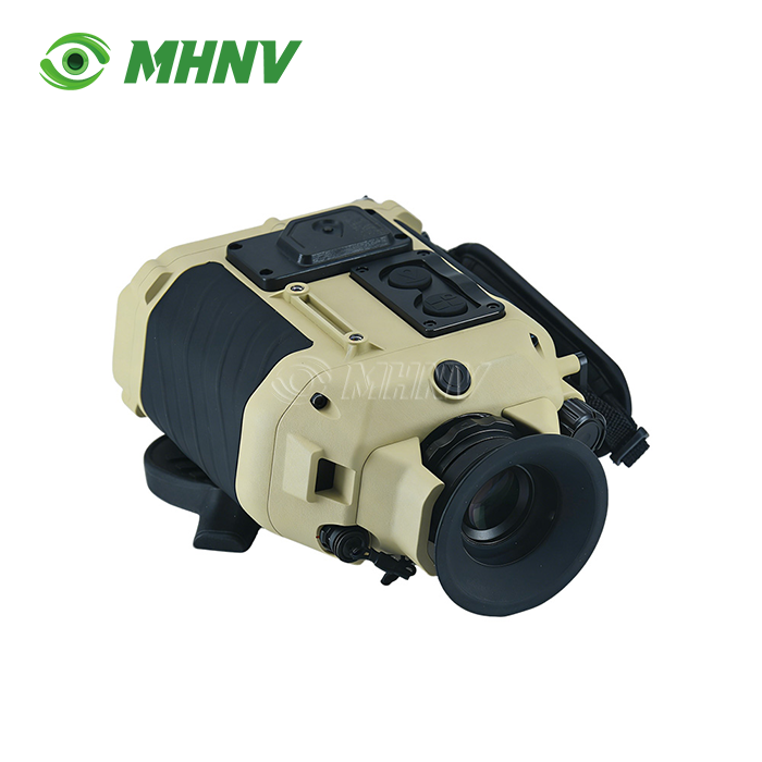
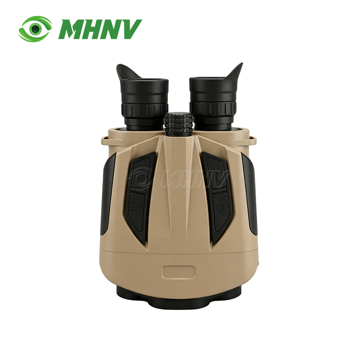
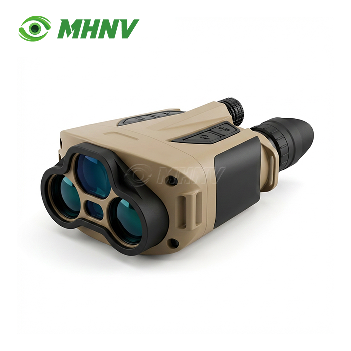
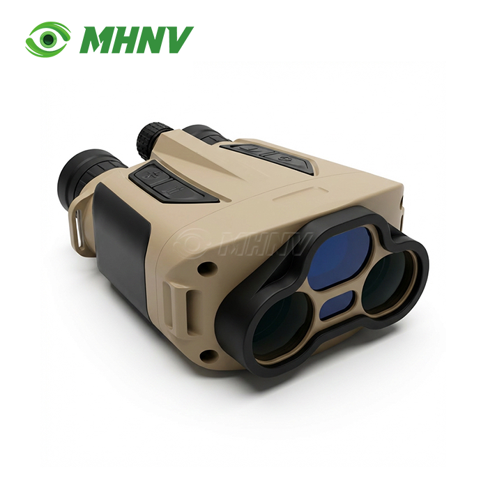
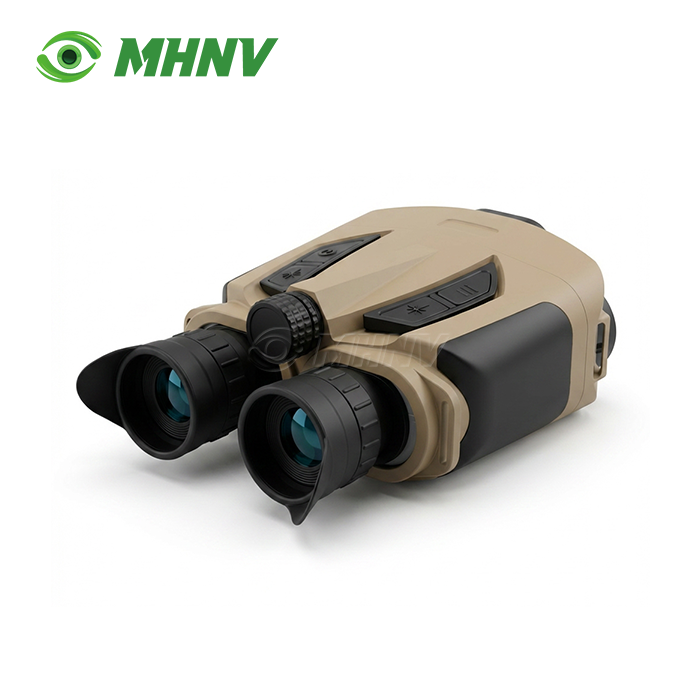
Xi'an MH Electronics And Technology Co., Ltd. delivers the MHNV MH-OL10 Laser Target Locator Module (LTLM), a handheld direct-view binocular system engineered for long-range target acquisition and grid-coordinate positioning. The module features 8× zero-latency optics, 10km eye-safe 1535nm laser rangefinder, electronic compass (0.06° azimuth accuracy after calibration), self-positioning (within ±3m), target positioning (within 20m), multi-target ranging, on-board ballistic calculator, and RS232 data output in 732g IP67-sealed body. The MH-OL10 is rated for operation in a temperature range of −40°C to +60°C and has a runtime of ≥8 hours. With grid call-out capability, the MH-OL10 is useful for artillery coordination, SAR dispatch, convoy spacing measurement, and command-post integration.

What Is the Laser Target Locator Module (LTLM)?
The device is a complex optoelectronic system for pinpointing the exact geographical coordinates of remote objects. It combines a high-precision laser rangefinder, a digital magnetic compass, a GNSS/GPS receiver and sophisticated positioning algorithms.
It automates 3D coordinate calculations, removing target location error and eliminating manual map-reading and separate sensor operations. They may give instantaneous latitude, longitude and elevation data by dead reckoning and triangulation, even in areas where GPS is denied, enabling rapid transmission of grids for fire support coordination, intelligence collection and situational awareness integration.
The LTLM combines range, compass, location and ballistic data into one workflow, thereby removing minutes of delay and human transcription error from observation missions, and providing combat-ready precision for forward observation, border surveillance and disaster-zone rescue operations.
Core Technical Parameters
| Parameter | Specification |
|---|---|
| Model | MHNV MH-OL10 |
| Optical Magnification | 8× direct-view |
| Laser Wavelength | 1535 nm (Class 1 eye-safe) |
| Max Range (Building) | ≥10 km |
| Max Range (Vehicle) | ≥7 km |
| Minimum Range | 50 m |
| Azimuth Accuracy | ≤0.3° (5 mil) field; ≤0.06° (1 mil) after map correction |
| Pitch/Roll Accuracy | ≤0.1° (2 mil) |
| Self-Positioning Accuracy | ±3 m |
| Target Positioning Accuracy | ≤20 m |
| Multi-Target Ranging | Supported; relative distance output |
| Ballistic Calculator | 10-set storage, 0.05 mil wind drift & firing angle precision |
| Data Interface | RS232 full data + scalable digital image output |
| Dimensions | 174 × 121 × 72 mm |
| Weight | 732 g |
| Battery Life | ≥8 hours continuous |
| Operating Temperature | −40°C to +60°C |
| Sealing | IP67 |
Five Enterprise-Grade Advantages
1. Zero-Latency Direct-View Optics with Dead-Battery Ranging
The 8× optical channel shoots photons directly to your eyepiece – no sensor, processor or frame buffer in the middle. No 30–80 ms digital delay, real scene seen immediately. If the battery dies you still have a reticle based rough ranging capability.
Digital systems based on CMOS displays are dark on power failure. Direct view keeps your mission alive amid jamming, electromagnetic interference and multi-day patrol circumstances.
2. 10 km Eye-Safe 1535 nm Laser, 7 km Vehicle Range
The 1535 nm wavelength is comfortably below Class 1 eye-safe limitations so you can range on friendly persons, civilian onlookers, and reflective objects without ocular hazard alerts.
The system supports battlefield reconnaissance, coastal watch and artillery observation considerably beyond the 2-4 km vehicle-range ceiling of ordinary 905 nm rangefinders, reaching 10 km on major buildings and 7 km on vehicles.
3. Sub-Mil Azimuth Accuracy + On-Board Ballistic Calculator
Azimuth accuracy is reduced to 0.06° (1 mil) after map rectification; pitch and roll are still 0.1° (2 mil). You get a target grid and firing solution that is accurate enough for direct call-for-fire on artillery, mortar, and drone-launched arms, with 0.05 mil wind drift and firing angle accuracy and 10-set ballistic storage.
It is a single instrument that does the function of a separate compass, angle sensor and ballistic slide rule, bringing together observation, range, placement and fire-control calculation in one operation.
4. Multi-Target Relative Ranging + RS232 and Scalable Digital Output
Range two or more targets in one session and read out the relative distance between them. Great for artillery fall of shot adjustment and convoy spacing.
Stream compass, GPS, range and ballistic data over RS232 to command-post laptops, drone ground stations or battle-management systems. Systems that provide just single-shot range readings need you to manually write down the results, adding minutes of delay and transcription error to each grid call-out.
5. IP67 Sealed, 732 g Body with 8-Hour Runtime Across −40°C to +60°C
It weighs under a kilogram, fits into normal patrol pouches and can run continuously for an entire shift on its internal power.
IP67 sealing and a wide temperature range cover arctic border patrol, desert armour spotting and coastal salt-spray monitoring without environmental derating – safeguarding your investment throughout the widest deployment envelope in the mid-weight rangefinder-binocular class.
Property of the Laser Target Locator Module (LTLM)
Laser Target Locator Module (LTLM) performance is governed by the SWaP-C optimization framework—Size, Weight, Power, and Cost.
Wavelength: 1535 nm (typically Erbium glass or OPO-shifted) ensures eye-safe operation and invisibility to standard night vision devices.
Ranging Performance: 5 km to 20 km capability with ±1 m accuracy.
Angular Accuracy: Digital magnetic compasses deliver azimuth accuracy within 0.5° and elevation within 0.2°.
Environmental Durability: Compliance with shock, vibration, and extreme temperature standards (−40°C to +60°C).
Connectivity: RS232, Ethernet, or Bluetooth for data output to Battle Management Systems.
The core advantage lies in multi-sensor fusion, which eliminates parallax errors associated with discrete devices.
Application Scenarios
Observation & Target Designation Forward
In rugged terrain, the product enables operators to designate targets for precision-guided arms with decimeter-level accuracy, thereby decreasing collateral damage.
Reconnaissance and Surveillance of Borders at Long Range
LTLMs are installed on tripods or mobile platforms and can continuously monitor unauthorised movement over large ocean or desert borders, even in poor visibility conditions.
Disaster Area Search and Rescue
With no landmarks available, SAR teams can use the LTLM to relay the precise location of survivors or threats to airborne extraction units, assuring the success of the mission despite atmospheric interference such as smoke or dust.

Quality Control Standards
Purchasers of the product systems prioritize rigorous inspection to ensure field readiness.
Boresight Alignment Testing: Ensures the optical axis of the thermal/day camera is perfectly aligned with the laser emitter axis to prevent targeting drift.
Range Probability of Detection (Pd): Verifies the module hits its maximum specified range at least 90% of the time under specific atmospheric conditions.
EMI/EMC Compliance: Testing ensures the module does not interfere with tactical radios and is not susceptible to external electronic jamming.
Salt Fog and Immersion Tests: Essential for maritime or coastal deployments to verify IP67/IP68 sealing integrity.
Laser Beam Divergence Measurement: Ensures laser energy remains concentrated over long distances for precise point-target ranging.

FAQ
Q: How does the product perform in heavy fog or rain?
A: Modern LTLMs use multi-pulse or last-pulse logic to filter out backscatter from atmospheric particles, allowing the sensor to distinguish the actual target from environmental noise. This digital signal processing technique compares multiple return pulses and selects the strongest or farthest echo, significantly improving detection in adverse weather. In heavy fog or rain, effective range may reduce by 20–40%, but the system remains operationally viable where purely optical rangefinders fail entirely.
Q: Can the digital magnetic compass be calibrated in the field to account for local magnetic anomalies?
A: Yes, professional LTLMs include a built-in calibration routine. You rotate the unit through a prescribed pattern to map local ferrous metal or electromagnetic interference. The firmware then applies real-time correction vectors, restoring azimuth accuracy to within 1 mil even near steel structures, vehicles, or power lines.
Q: Is the 1535 nm laser detectable by the enemy?
A: While 1535 nm is eye-safe and invisible to standard image-intensified tubes, it can be detected by specialized short-wave infrared sensors. However, its low probability of intercept is superior to older 1064 nm systems, and the brief pulse duration minimizes detection windows during operational ranging sequences.
Q: What is the typical battery life during continuous operation?
A: High-end modules are designed for low power consumption, typically supporting over 500–1000 ranging cycles on a single set of CR123 or rechargeable lithium batteries. The MHNV MH-OL10 delivers ≥8 hours of continuous operation, covering a full working day without battery replacement.
Q: Does the LTLM support Cursor-on-Target (CoT) protocols?
A: Yes, most industry-standard LTLMs are programmed to output CoT data packets via RS232 or Bluetooth, ensuring seamless plug-and-play integration with Android Tactical Assault Kit and other situational awareness software. This eliminates manual coordinate entry and accelerates decision cycles in joint operations.

Contact Us for Custom Solutions
Ready to integrate the Laser Target Locator Module (LTLM) into your observation platform? Contact our engineering team at sarah@mh-elec.com for OEM/ODM customization, technical specifications, and volume pricing.
YOU MAY LIKE