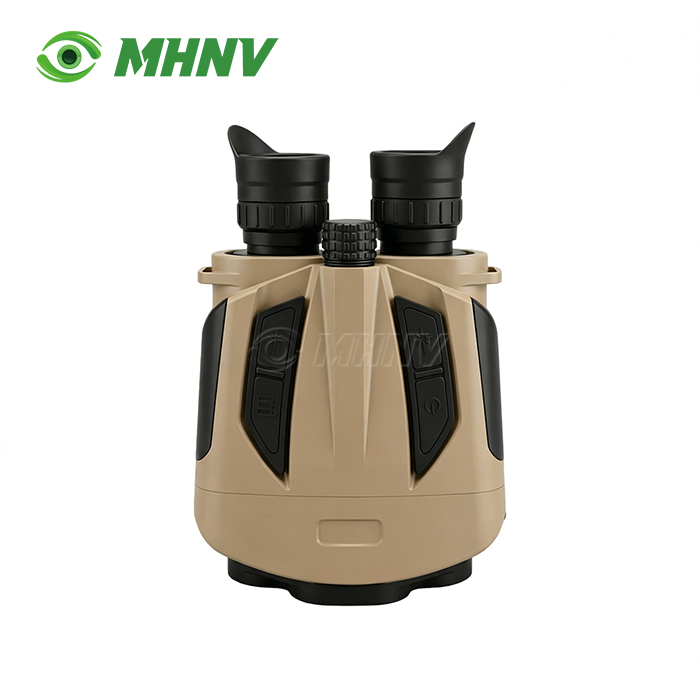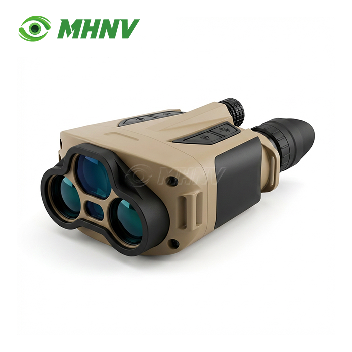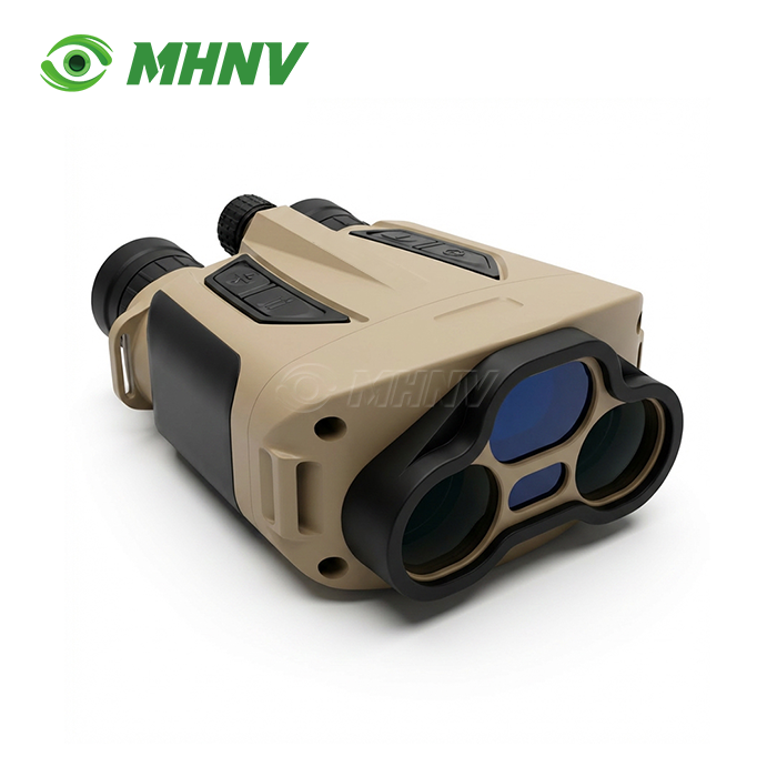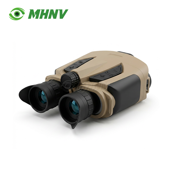
Laser Target Locator
Professional 10km Eye-Safe Laser Target Locator with On-Board Ballistic Calculator and Direct-View Optics
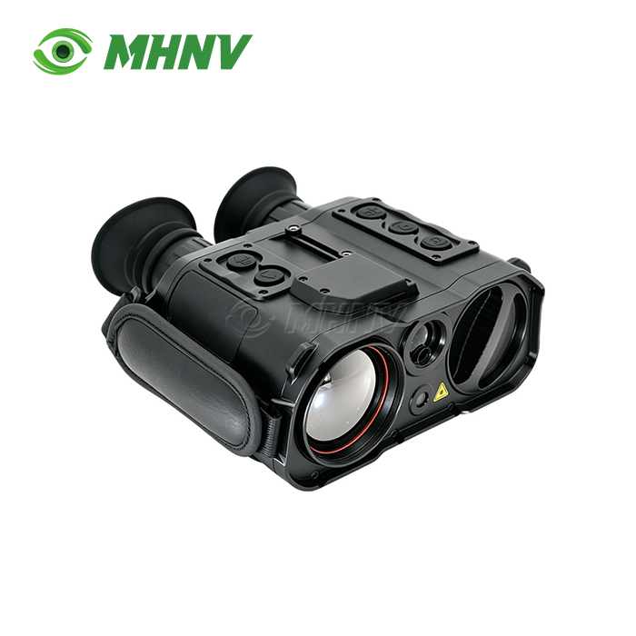
Advanced reconnaissance and forward observation missions demand precision tools that deliver reliable target coordinates under operational stress. The Laser Target Locator from MHNV® combines direct-view 8× optics, 10 km eye-safe laser ranging, electronic compass, self-positioning, and ballistic calculation in a single IP67-sealed handheld platform. The MHNV MH-OL10 delivers sub-mil azimuth accuracy after map correction, ≤20 m target positioning accuracy, and multi-target relative ranging—enabling direct call-for-fire on artillery, drone strike coordination, and search-and-rescue asset dispatch. With 732 g total weight, 8-hour continuous runtime, and −40 °C to +60 °C operating range, this system meets the demanding envelope of arctic patrol, desert spotting, and coastal surveillance missions.
Direct-View Optical Design with Zero Latency
The MHNV MH-OL10 employs an 8× magnification direct-view optical channel that feeds photons directly to the eyepiece. No sensor, processor, or frame buffer sits between the operator's eye and the observed scene. This architecture guarantees zero latency and eliminates frame drop entirely.
Digital acquisition systems built on CMOS sensors introduce 30 to 80 milliseconds of processing delay. They also become useless once the battery dies. The direct-view design keeps the mission alive under jamming, electromagnetic interference, and prolonged power loss.
Even when electronics are powered off, the operator retains the ability to conduct reticle-based rough ranging. This capability is decisive on multi-day patrols and forward observation missions. During jamming or battery depletion, the optical path remains fully operational.

10 km Eye-Safe Laser Ranging
The system integrates a 1535 nm Class 1 eye-safe laser rangefinder. This wavelength remains eye-safe at higher power levels, permitting the operator to range across friendly troops, civilian bystanders, and reflective surfaces without triggering ocular hazard warnings.
Maximum measuring range reaches 10 km on large building targets and 7 km on vehicle-size targets. Minimum range starts at 50 m for close-in work. The 1535 nm wavelength is invisible to most Gen 3 image intensifiers, providing better operational stealth than traditional 905 nm rangefinders.
Typical 905 nm systems cap vehicle-target ranging at 2 to 4 km. The MHNV MH-OL10 extends that envelope to 7 km on vehicle-class reflectors. This extended reach covers battlefield reconnaissance, coastal watch, and artillery observation missions that shorter-range systems cannot address.
Sub-Mil Compass Accuracy and On-Board Ballistic Calculation
The integrated electronic compass delivers 0.3 degree (5 mil) azimuth accuracy in field conditions. After magnetic map correction, accuracy tightens to 0.06 degree (1 mil). Pitch and roll accuracy hold at 0.1 degree (2 mil).
Self-positioning accuracy reaches ±3 m. Target positioning accuracy stays within ≤20 m. These figures enable direct grid call-out for artillery, mortar, and drone-launched munitions without manual transcription or separate calculation tools.
The on-board ballistic calculator stores 10 sets of ballistic data. Real-time meteorological data collection feeds wind drift and firing angle calculations. Wind drift precision holds at 0.05 mil. Firing angle precision also holds at 0.05 mil. Custom ballistic entry supports user-defined munitions.
The operator no longer needs a separate compass, angle sensor, and ballistic slide rule. One device handles observation, ranging, positioning, and fire-control calculation in a single workflow.
Multi-Target Relative Ranging and Digital Data Output
The Laser Target Locator supports multi-target relative distance measurement. The operator can range two or more targets in one session and read out the relative distance between them. This feature is useful for adjusting artillery fall-of-shot or judging convoy spacing.
RS232 full data output plus scalable digital image interface enable integration into command-post displays, drone hand-off systems, and battle-management software. Compass, GPS, range, and ballistic data stream directly into laptop applications or ground stations.
Systems that offer only single-shot range reading force the operator to write results on paper and manually transcribe them. This process adds minutes of delay and human transcription error to every grid call-out. The MHNV MH-OL10 eliminates that bottleneck.
Map positioning correction is supported. The device can use known reference points and its internal compass to calculate relative target positions even when GNSS is jammed or unavailable.
Technical Specifications
| Parameter | Value |
|---|---|
| Model | MHNV MH-OL10 |
| Architecture | Handheld direct-view binocular target acquisition system |
| Optical magnification | 8× |
| Laser wavelength | 1535 nm eye-safe |
| Laser class | Class 1 eye-safe |
| Maximum range (building target) | ≥10 km |
| Maximum range (vehicle target) | ≥7 km |
| Minimum range | 50 m |
| Azimuth accuracy | ≤0.3° (5 mil) |
| Azimuth accuracy (map corrected) | ≤0.06° (1 mil) |
| Pitch and roll accuracy | ≤0.1° (2 mil) |
| Self-positioning accuracy | ±3 m |
| Target positioning accuracy | ≤20 m |
| Multi-target relative ranging | Supported |
| Ballistic calculator | Supported, real-time meteorological input |
| Ballistic data storage | 10 sets |
| Wind drift precision | 0.05 mil |
| Firing angle precision | 0.05 mil |
| Custom ballistic entry | Supported |
| Digital image output | Scalable |
| Data interface | RS232 full data transmission |
| Dimensions (L × W × H) | 174 mm × 121 mm × 72 mm |
| Weight | 732 g |
| Working time | ≥8 hours continuous |
| Operating temperature | −40 °C to +60 °C |
| IP rating | IP67 |
IP67 Sealed Compact Envelope
The size of the device is 174 mm x 121 mm × 72 mm and the weight is only 732 g. Compact envelope fits in ordinary patrol bags and minimises operator fatigue during long missions.
Full IP67 sealing protects the internal electronics from immersion and dust entry. Its wide temperature range of -40 to +60 degrees C allows arctic border patrol, desert armour spotting and coastal salt-spray monitoring without environmental derating.
It is powered internally and will run for at least 8 hours on a single charge. This runtime supports full day patrol cycles without battery change or external power. Low weight, long run life and environmental resilience safeguards the buyer investment across the widest deployment envelope in the mid-weight rangefinder-binocular class.

FAQ
Q: Is the laser used in a product safe for the human eye?
A: Yes, the MHNV MH-OL10 utilizes a Class 1 eye-safe 1535 nm laser which is invisible to the naked eye and most night vision devices, ensuring operator stealth and safety even when ranging across friendly troops or civilian bystanders. This wavelength poses no risk to ocular health and complies with international eye-safety standards for handheld rangefinding systems.
Q: How does atmospheric weather affect the device?
A: While heavy fog or rain can scatter laser pulses, the system employs multi-pulse logic and last-target priority algorithms to filter out atmospheric noise and improve detection probability. Direct-view optics remain fully functional regardless of weather, so the operator retains visual observation and reticle-based rough ranging even when laser returns are degraded.
Q: Can the device work without GPS?
A: Yes, if GNSS is jammed or unavailable, the MH-OL10 uses known reference points combined with its internal electronic compass to calculate relative target positions. Map positioning correction further enhances accuracy when satellite navigation is denied, ensuring mission continuity in contested electromagnetic environments.
Q: How often does the compass need calibration?
A: To maintain sub-5 mil azimuth accuracy, field calibration is recommended when moving between significantly different geographic magnetic zones or after exposure to large ferrous objects or strong electromagnetic interference. The calibration procedure is quick and can be performed in the field without specialized equipment.
Q: Does it integrate with battle-management software?
A: Absolutely, the device features RS232 full data output and scalable digital image interface specifically designed to export position location information, range, azimuth, and ballistic solutions directly into command-post laptops, drone ground stations, ATAK systems, and Windows-based C4I software for seamless data fusion and collaborative targeting.

Contact MHNV® for Detailed Specifications and Customization
Our engineering team supports optical design, firmware modification, mechanical redesign, and data interface integration. For detailed specifications, volume pricing, or integration consulting for Laser Target Locator, contact sarah@mh-elec.com today.
YOU MAY LIKE
.webp "Laser Target Locator Module (LTLM)")