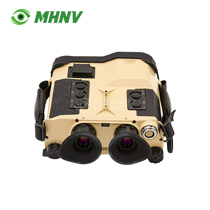
Multi-Spectral Fusion Target Locator
Advanced Multi-Spectral Fusion Target Locator – Professional 8-in-1 Reconnaissance System for All-Weather Operation
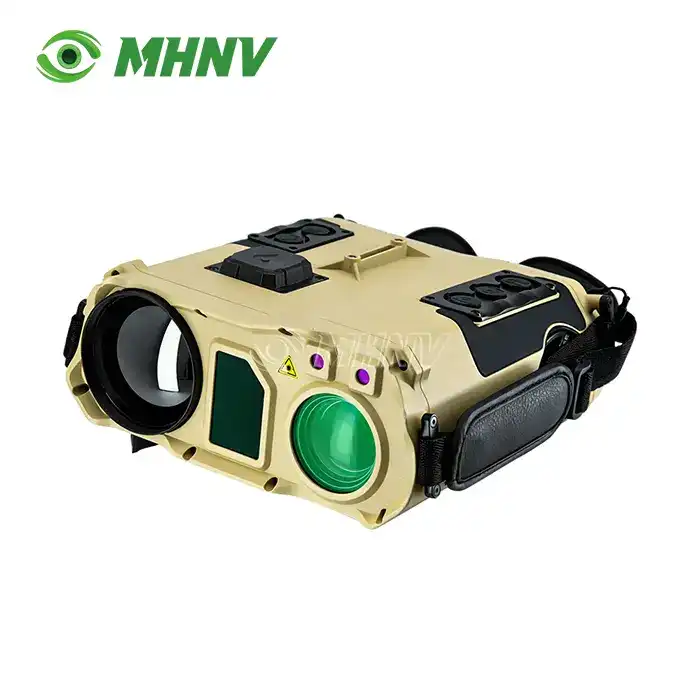
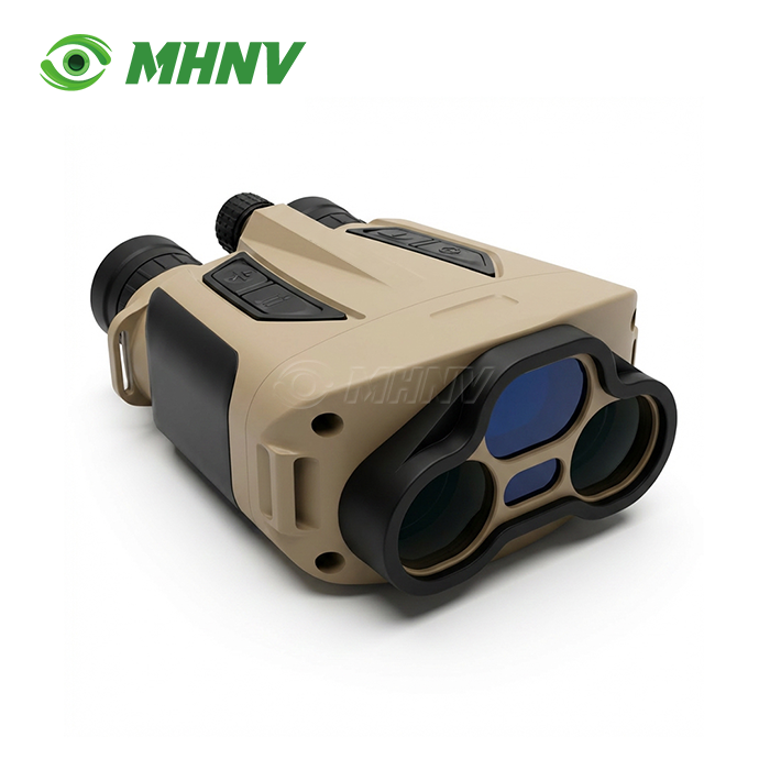
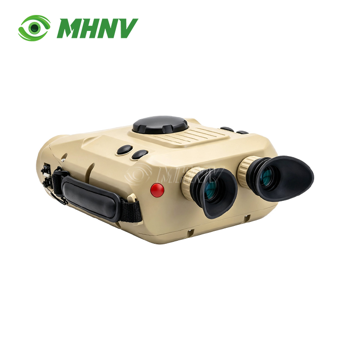
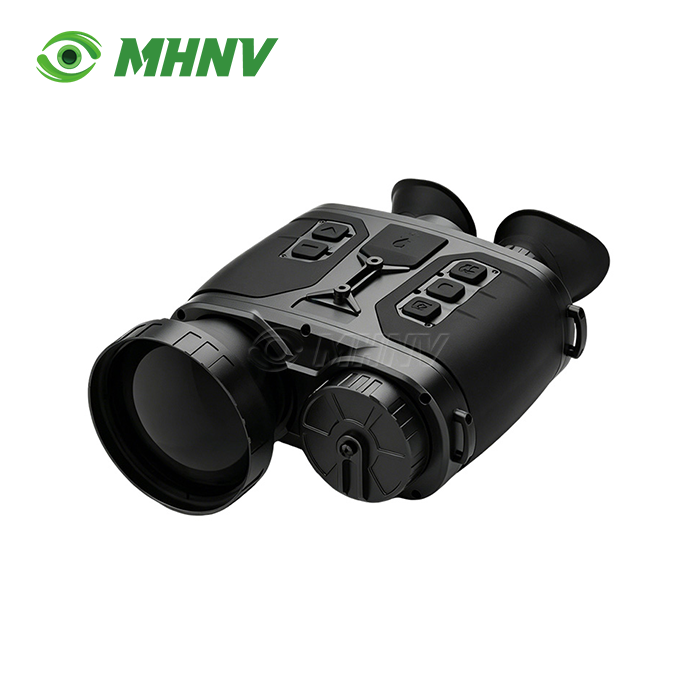
The MHNV® MH-IRT5 Multi-Spectral Fusion Target Locator is an optoelectronic observation and positioning device designed to professional standards for difficult surveillance, reconnaissance and search missions under all weather conditions. The gadget is enterprise-grade and fuses visible light (1920x1080px resolution), thermal imaging (640x512px@12µm) and low-light vision (800x600px@8µm) into a single output, making it possible to identify persons and vehicle targets at ranges of more than 3km and 6km respectively. It is IP67 environmentally protected and uses a 1535nm eye-safe laser to range up to 6 km. It incorporates eight functions including GPS/Beidou positioning, digital compass and ballistic computation. It provides comprehensive field intelligence in a compact 2.3kg package that operates reliably from -40°C to +60°C.
Multi-Spectrum Image Fusion Technology
Today's challenging observation demands more than single sensor solutions. Your operations can not afford to be visually blind in smoke, fog or utter darkness.
The fusion design merges three separate sensor channels. Full-color visible light provides high-resolution structural detail and textural information necessary for target identification. Thermal imaging can see heat signatures that regular optics can't see and can see through things in the air that block vision. Low-light vision improves nite operating effectiveness from dusk to morning.
These data streams are fused in real time with processing latency <30ms via digital fusion techniques. The system is free of parallax error due to the precision boresight alignment held within a 0.5 mrad tolerance. This provides operators simultaneous access to thermal contrast and visual context , drastically decreasing the cognitive load of target assessment .
Four selectable image modes are designed to meet mission requirements, including full-color daylight observation, pure thermal imaging for heat signature detection, low-light enhancement for twilight conditions, and infrared-low-light fusion that overlays thermal targets on environmental background detail, particularly effective against camouflaged or concealed subjects.
Technical Specifications Overview
| Parameter | Specification |
|---|---|
| Dimensions | 235mm × 220mm × 110mm |
| Weight | 2.3kg (with battery) |
| Operating Temperature | -40°C to +60°C |
| Protection Rating | IP67 (dustproof, waterproof) |
| Visible Light Resolution | 1920 × 1080 px |
| Visible FOV | 44° × 34° to 2.4° × 1.8° (variable zoom) |
| Thermal Resolution | 640 × 512 px @ 12μm |
| Thermal FOV | 7.32° × 5.86° |
| Low-Light Resolution | 800 × 600 px @ 8μm |
| Low-Light FOV | 7.32° × 5.86° |
| Laser Rangefinder Wavelength | 1535nm (eye-safe Class 1) |
| Ranging Distance | 30m – 6km (vehicle targets) |
| Laser Pointer | 850nm 50mW (invisible) / 520nm 30mW (visible) |
| Recognition Distance | Personnel >3km / Vehicles >6km |
Eight Integrated Functions for Complete Reconnaissance
Your procurement specifications require consolidation of multiple capabilities into single-platform solutions. The product delivers.
Laser Ranging: 1535nm Class 1 eye-safe laser provides accurate distance measurement without operator risk or protective equipment requirements. Measurement range extends from 30 meters to 6 kilometers for vehicle-class targets.
Angle Measurement: Integrated inclinometer calculates elevation and azimuth angles, essential for indirect fire coordination and topographic mapping.
Meteorological Sensing: Built-in environmental sensors monitor temperature, atmospheric pressure, and humidity—data directly integrated into ballistic calculations.
GPS/Beidou Positioning: Dual-constellation satellite receivers deliver precise geographic coordinates for target location sharing across command networks.
Digital Compass: Three-axis magnetometer provides accurate heading reference independent of GPS availability.
Ballistic Computation: Optional trajectory calculation module processes multi-munition ballistic profiles, accounting for range, angle, and meteorological variables.
Data Logging: Internal memory stores reconnaissance data, including time-stamped coordinates, range measurements, and captured imagery for post-mission analysis.
Image Fusion Processing: FPGA-based real-time fusion engine manages multi-sensor data streams with automatic non-uniformity correction and dynamic range optimization.
Rugged Environmental Performance
Field equipment is subject to harsh circumstances. You need demonstrated in-field durability.
Enclosure rated IP67 for total protection against dust intrusion and temporary immersion to 1 metre depth. Sealed construction to exclude moisture during severe rain activities.
Thermal management system provides operational stability in temperature extremes of -40°C to +60°C. Internal heating elements prevent sensor degradation in frigid settings, while passive cooling construction removes mechanical sources of failure in desert environments.
Mechanical design meets shock and vibration resistance criteria. The optical bench mounting device preserves sensor alignment throughout carriage in the vehicle and when used handheld over uneven terrain.
Professional Application Scenarios
Border Surveillance Operations: The Multi-Spectral Fusion Target Locator enables long-range detection of unauthorized crossings in total darkness. Thermal imaging identifies heat signatures at 3+ km ranges, while visible-light zoom confirms identification details once targets approach illuminated zones or dawn breaks.
Search and Rescue Deployment: Post-disaster scenarios involving structural fires generate dense smoke that defeats conventional optics. Thermal penetration locates survivors by body heat signatures, while fusion mode provides spatial awareness of structural hazards and debris fields through partial visual channel transparency.
Maritime Patrol and Enforcement: Coastal surveillance faces challenges from sea clutter, atmospheric haze, and horizon detection at extended ranges. Integrated laser rangefinding delivers precise distance measurement essential for navigation safety and intercept calculations, while thermal imaging detects vessel heat signatures against cold ocean backgrounds.
Critical Infrastructure Protection: Perimeter security for energy facilities, transportation hubs, and industrial complexes requires 24/7 threat detection capability. Multi-spectral observation identifies approaching personnel or vehicles regardless of lighting conditions or weather obscurants.

Quality Assurance and Testing Standards
Your specification compliance requires documented validation procedures. MHNV® implements comprehensive quality control.
Image Registration Verification: Every unit undergoes pixel-alignment testing across full zoom range to ensure thermal and visible channels maintain perfect overlay without parallax distortion.
Modulation Transfer Function Testing: Optical system performance receives MTF measurement at specific spatial frequencies, quantifying contrast transfer capability that determines ultimate image sharpness.
Environmental Stress Screening: Production units complete thermal cycling and random vibration testing per MIL-STD-810G protocols to identify latent manufacturing defects before shipment.
Laser Safety Certification: Rangefinder output receives spectral analysis and power measurement to verify Class 1 eye-safety compliance and distance measurement accuracy validation (±1m at 5km range).
Thermal Sensor Calibration: Non-uniformity correction algorithms undergo burn-in testing with high-contrast heat sources to prevent image ghosting or residual artifacts during operational deployment.
Each shipped product includes serialized QC documentation with test results, calibration certificates, and traceability records.


FAQ
Q: What distinguishes digital fusion from optical fusion in multi-spectral systems?
A: The product digitises the sensor streams separately via digital fusion technology, then utilises FPGA or SoC processing to align and blend the pixels. This technique permits advanced display modes such as highlight overlay, edge detection outline and adaptive contrast enhancement which are not achievable with simply optical beam-splitter techniques. This digital processing allows for post-acquisition modification of the fusion ratios, false colour mapping of the thermal image, and electronic stabilisation of the image on both channels concurrently for more operational flexibility.
Q: Does the thermal camera see through normal glass windows?
A: The visible light channel can be transmitted through normal glass with little attenuation whereas the long wave infrared thermal radiation (8–14 μm) is near totally reflected from the surfaces of glass. The fusion algorithm, however, offers operational advantage in that the interior windows' visual transparency is overlaid with the thermal signatures sensed around the edges of the frame. This enables the operators to simultaneously assess both the interior visible details and the exterior thermal activity patterns to gain a comprehensive situational awareness.
Q: How often should the multi-spectral sensor be field calibrated?
A: The thermal sensor performs internal automatic non-uniformity correction (NUC) every few minutes during operation to compensate for the detector drift and ambient temperature variations. This method does not require any operator participation. However, to maintain the required accuracy tolerances for fused imaging and laser rangefinder coalignment, a thorough boresight alignment verification between the visible, thermal and low-light optical axs must be conducted annually or after major mechanical shock events.
Q: Does the humidity of the atmosphere impact the multi-spectral performance?
A: High relative humidity increases atmospheric attenuation especially in the long-wave infrared band, lowering effective detection range for thermal imaging. The product compensates through intelligent sensor prioritisation. If thermal contrast is degraded by moisture content, the fusion algorithm automatically weighs the visible/NIR channel contribution more heavily, preserving target detection capability across varying environmental conditions without operator adjustment.
Q: Are these systems subject to international export restrictions?
A: Yes. Export controls for dual-use technologies include multi-spectral targeting systems with high-resolution sensors and high-frame-rate thermal imaging (usually >9Hz). Systems may require specific authorisation under ITAR (International Traffic in Arms Regulations) or EAR (Export Administration Regulations) Category XII depending on technological characteristics and country of destination. B2B procurement teams should ensure that they check the current export classification and get the relevant licenses before starting overseas transactions.

Partner With MHNV® for Your Reconnaissance Solution
Contact our team for detailed Multi-Spectral Fusion Target Locator specifications, performance demonstrations, or project quotations. Reach us directly: sarah@mh-elec.com
YOU MAY LIKE