Handheld Multi-Spectral Targeting System
Advanced Handheld Multi-Spectral Targeting System | Professional All-Weather Observation Solution with Thermal & Visible Light Integration
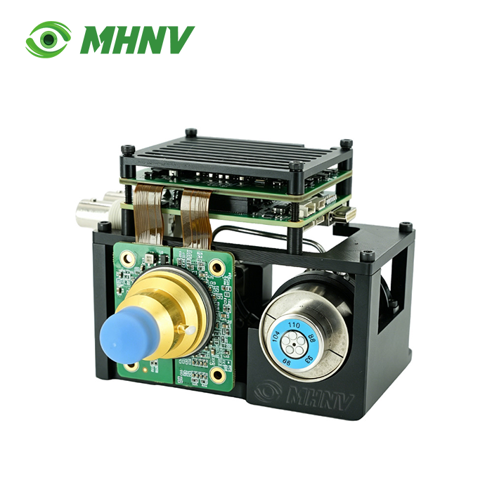
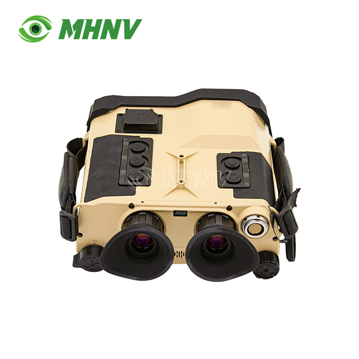
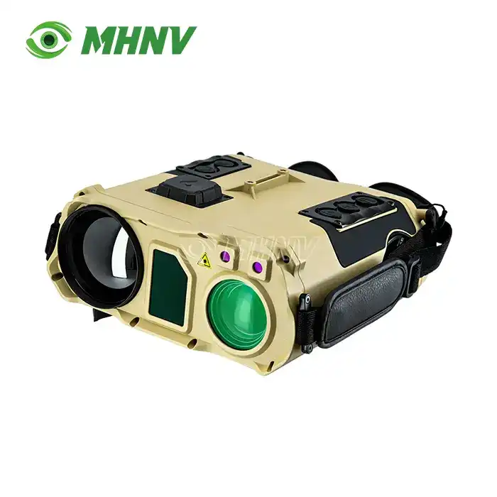
The Handheld Multi-Spectral Targeting System represents a sophisticated portable optoelectronic platform engineered for demanding operational environments. MHNV®'s MH-IRT4 model integrates 640×512px thermal imaging, 1920×1080 visible light sensors, 6km laser rangefinding capability, and multi-mode GPS positioning within a rugged 2.1kg package. This professional-grade system achieves personnel target identification beyond 1km in thermal mode and vehicle detection exceeding 6km in visible spectrum, while maintaining IP67 environmental protection. The coaxial optical architecture ensures precise alignment across all sensing channels, delivering reliable target acquisition through darkness, haze, and adverse weather conditions.
What Makes Multi-Spectral Integration Essential for Target Acquisition?
Modern observation challenges demand more than single-spectrum solutions. The product addresses critical operational limitations by combining multiple imaging technologies within a unified handheld platform.
Traditional observation devices suffer from "sensory isolation"—thermal sensors excel in darkness but lack structural detail, while visible light cameras fail in low-illumination scenarios. This integration bridges that gap through sophisticated image fusion algorithms that overlay thermal heat signatures onto high-resolution visible imagery.
The MH-IRT4 processes dual-channel data simultaneously, allowing operators to identify targets concealed by environmental factors that would defeat conventional optics. The 7.32°×5.86° thermal field of view complements the 44°×34° to 2.4°×1.8° coaxial optical zoom range, providing both wide-area surveillance and detailed target examination capabilities.
Technical Specifications Overview
| Imaging Component | Performance Parameters |
|---|---|
| Thermal Resolution | 640×512 pixels, 12μm pitch |
| Thermal FOV | 7.32°×5.86° |
| Visible Resolution | 1920×1080 Full HD |
| Visible FOV | 44°×34° to 2.4°×1.8° (coaxial zoom) |
| Detection Range (Personnel) | >1km thermal / >3km visible |
| Detection Range (Vehicle) | >2km thermal / >6km visible |
| Laser Rangefinder | Specifications |
| Wavelength | 1535nm (eye-safe) |
| Maximum Range | >6km (vehicles) / >8km (structures) |
| Accuracy | ±1m |
| Navigation & Positioning | Capabilities |
| Satellite Systems | BeiDou / GPS / GLONASS |
| Coordinate Formats | WGS84, CGCS2000, SK42, Gauss-Kruger, UTM, MGRS |
| Azimuth Accuracy | 0.5° RMS |
| Pitch Accuracy | 0.1° RMS |
| System Performance | Values |
| Display | 1080p FHD OLED |
| Operating Time | >9 hours continuous |
| Weight | 2.1kg |
| Dimensions | 235mm×205mm×85mm |
| Protection Rating | IP67 |
Core Advantages for Professional Operations
Coaxial All-Weather Architecture
The dual-channel design maintains perfect optical alignment between thermal and visible sensors. This coaxial configuration eliminates parallax errors that plague offset multi-sensor systems, ensuring target coordinates remain accurate across the entire observation range.
Precision Orientation with Triple-North Measurement
The MH-IRT4 calculates magnetic, true, and grid north simultaneously using 60-00/64-00 mil-scale measurements. Intelligent magnetic declination correction automatically adjusts for geographic location without manual intervention, streamlining field operations.
Multi-Reference Calibration System
Beyond standard electronic compass functionality, the system supports calibration through ground reference points, angular measurements, and celestial navigation inputs. This flexibility ensures accurate targeting data even in magnetically-disturbed environments.
Professional Coordinate System Support
Global deployment requires adaptability. The Handheld Multi-Spectral Targeting System processes coordinates in SK42, WGS84, and customizable regional datum systems, with output formatting in Gauss-Kruger, UTM, or MGRS conventions as mission parameters require.
Multi-Target Relative Positioning
Advanced computational algorithms calculate spatial relationships between multiple observed targets. This professional feature enables operators to establish tactical geometry and predict movement patterns across complex operational areas.
Real-Time Data Transmission Capabilities
Modern operations demand immediate information sharing. The MH-IRT4 provides HDMI real-time HD video transmission for command-post monitoring and RS232 full-data export for integration with external battle management systems.
USB and PAL interfaces support additional connectivity requirements, while the multi-function expansion interface allows for mission-specific peripheral integration. This connectivity architecture transforms the device from a standalone observation tool into a networked intelligence asset.
Environmental Durability for Demanding Conditions
IP67 protection ensures functionality during rain, dust storms, and temporary submersion. The ruggedized housing withstands operational shock and vibration while maintaining optical alignment across the thermal, visible, and laser channels.
Battery management systems optimize power distribution across multiple sensors, achieving over 9 hours of continuous operation. This endurance eliminates mid-mission recharging concerns during extended surveillance or reconnaissance tasking.
Application Scenarios Across Professional Sectors
Border Security and Patrol Operations: The combination of long-range visible light identification and thermal detection through atmospheric interference makes the system invaluable for perimeter monitoring. Vehicle detection beyond 6km provides early warning capabilities, while thermal imaging identifies concealed personnel in total darkness.
Search and Rescue Coordination: Thermal sensors rapidly locate individuals in wilderness environments or disaster zones where visible observation proves ineffective. GPS coordinate output enables precise extraction planning and resource deployment.
Industrial Infrastructure Inspection: Power line surveys, pipeline monitoring, and facility security benefit from the dual-spectrum approach. Thermal anomalies indicate equipment failures invisible to standard cameras, while visible zoom confirms structural conditions.
Wildlife Management and Conservation: Non-invasive observation of nocturnal species becomes possible without illumination that disturbs natural behaviors. The 6km laser rangefinder accurately measures distances for habitat mapping and population studies.
Maritime and Coastal Surveillance: The system penetrates sea spray and coastal haze that defeats conventional optics, identifying vessels at extended ranges. Precise coordinate generation supports interdiction planning and search pattern optimization.

Customization Options for Specialized Requirements
MHNV® offers full ODM services to suit specific operational parameters. Firmware customisation features include interface language option, coordinate system addition and data output formatting. Mechanical adjustments meet mounting needs and optical variations vary magnification ratios and field-of-view choices.
Branded packaging and translation of user documentation and specialised training materials assist customer-specific deployment initiatives. We work hand-in-hand with clients through our engineering teams to customise the product to certain operational environments.

FAQ
Q: What accuracy gains in targeting does the coaxial architecture offer over offset sensor configurations?
A: Coaxial alignment means that the thermal, visible and laser channels have the same optical axis, such that parallax error ( which rises with target distance ) is eliminated. The offset systems change in viewpoint between sensors , so you have coordinate translation errors that add up at long ranges . At 5km ranges , you may be talking meters of inaccuracy . The coaxial architecture of the MH-IRT4 means that the target you see in the thermal channel is the same target laser rangefinder measurement point and the same target point on the visible image. You get consistent ±1m accuracy across the whole 6km+ operational envelope no matter which sensor you are actively viewing.
Q: What is the difference between professional image fusion and a picture-in-picture overlay?
A: Professional fusion performs pixel-level registration between thermal and visible sensors, then applies computational algorithms that intelligently blend complementary information—thermal heat signatures provide target detection cues while visible detail reveals structural features. The simplest form of picture-in-picture is just showing one image inside another with no geographical linkage or data integration. The system processes all channels simultaneously and delivers a unified tactical picture where thermal hotspots are viewed in context with high resolution visible surrounds, dramatically enhancing target recognition speed and situation awareness.
Q: Is the system capable of exporting coordinate data to external mapping or command systems?
A: Yes, MH-IRT4 has numerous output options, including RS232 complete data output, USB interface and HDMI out in real time. Coordinate data in WGS84, UTM, MGRS or other datum systems can stream to tablets, battlefield management networks or Geographic Information Systems for use with operations planning tools. This interoperability translates field observations into actionable intelligence and disseminates it across command levels.
Q: What is the operation safety of the 1535nm laser wavelength?
A: Yes, the 1535nm wavelength falls within the eye-safe spectrum range in which the intensity of the beam hitting the retina is limited by ambient water vapour absorption even in direct exposure. This allows the MH-IRT4 to emit sufficient laser intensity for 6km+ vehicle ranging, yet still be Class 1 eye safe certification. Operators can do training exercises and peacetime operations without the protective eyewear requirements or range safety issues associated with shorter wavelength laser systems.
Q: How often do I need to maintain the system to keep it accurate?
A: The thermal sensor carries out automatic NUC (Non-Uniformity Correction) internally, and no assistance from the operator is required. Factory calibration of the coaxial boresight alignment is performed with mechanical stability to allow continuous field use. MHNV® recommends annual verification testing of optical alignment, laser accuracy and compass calibration to ensure they are within specification, especially following any large shock occurrences. Basic lens cleaning and battery maintenance is all that is required for routine field operations and the ruggedised build limits degradation over ordinary deployment cycles.

Partner with MHNV® for Professional Targeting Solutions
For technical specifications, customization consultations, or Handheld Multi-Spectral Targeting System partnership inquiries, contact our international team at sarah@mh-elec.com.
YOU MAY LIKE
.webp "Portable Target Acquisition System (TAS)")