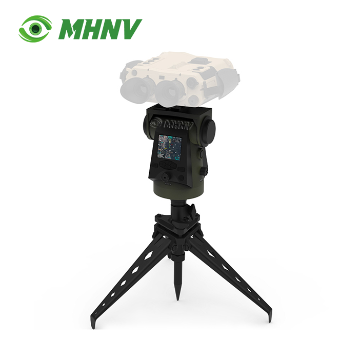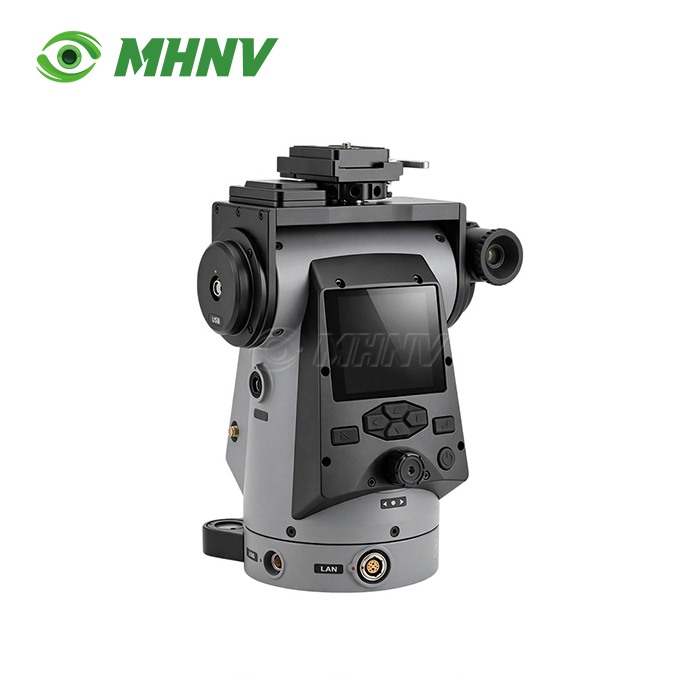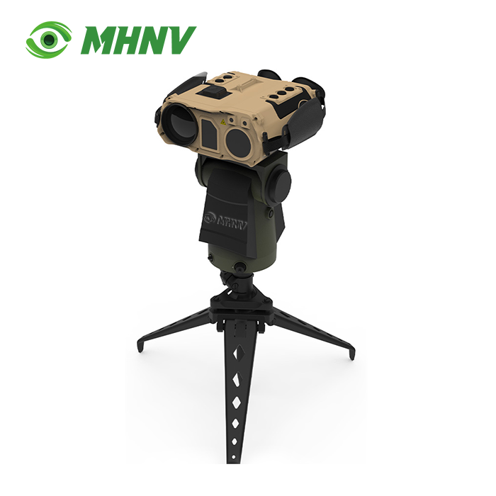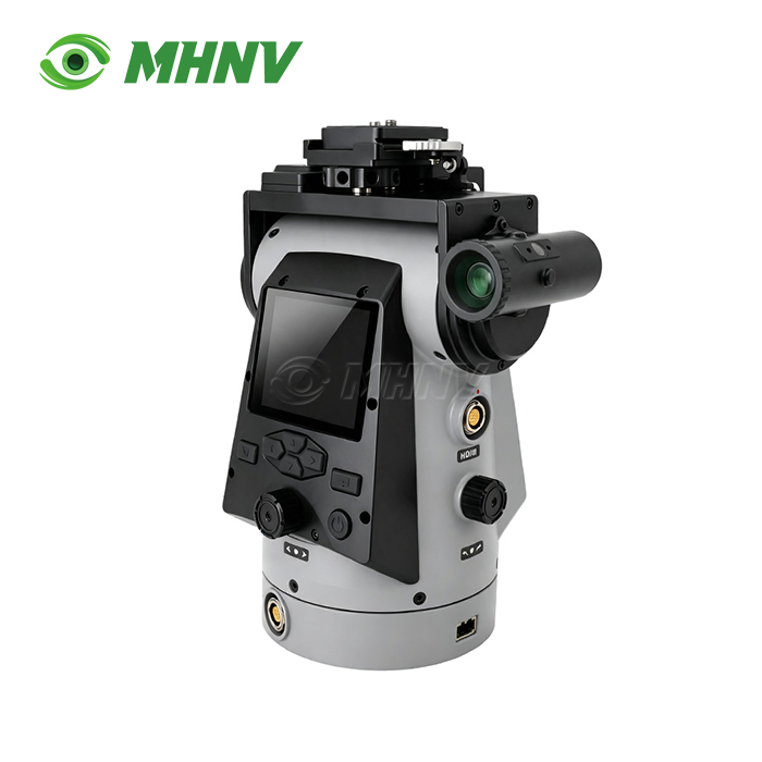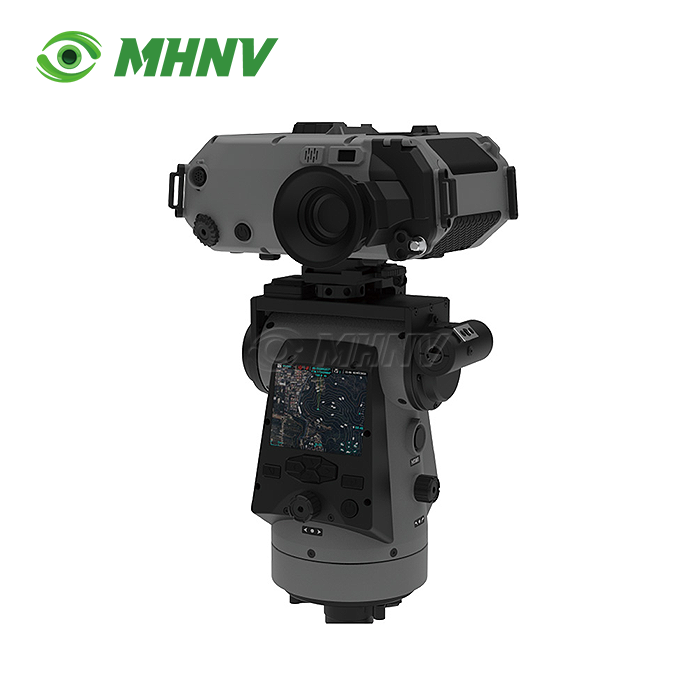
Variable Speed Pan Tilt Unit
Variable Speed Pan Tilt Unit – Precision Payload Platform for Multi-Sensor Surveillance and Remote Observation Applications
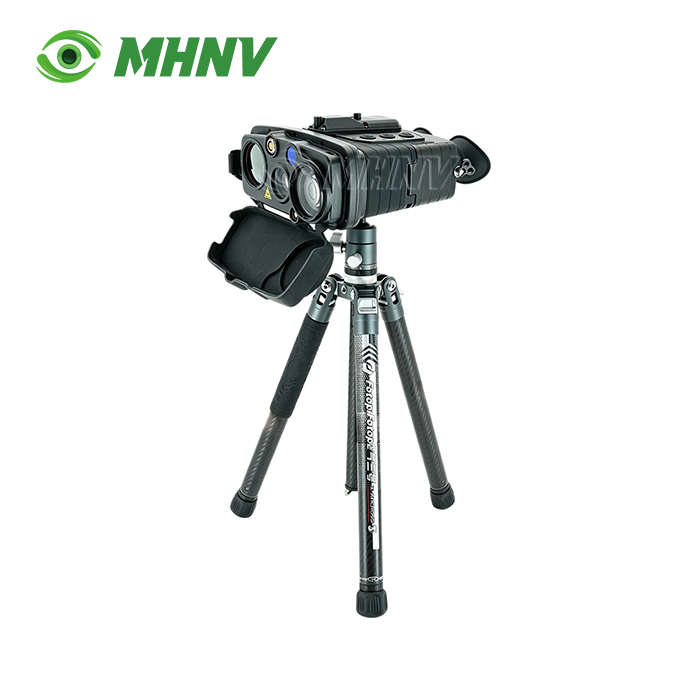
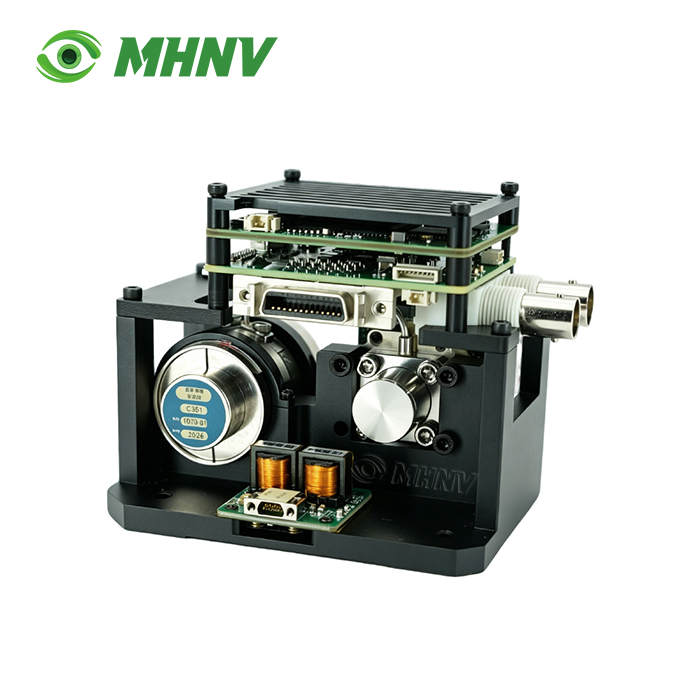
The MHNV MH-PTZ16 Variable Speed Pan Tilt Unit is a precision-engineered payload positioning platform for thermal binoculars, nite vision devices, day cameras and multi-sensor fusion systems for use in surveillance, coastal watch, wildlife survey and border observation. This platform can carry ≥4 kg payload, rotate 360° in azimuth, pitch from −45° to +45°, and have ≤0.02° (0.3 mil) positioning accuracy, enabling automated sector scanning and repetitive target return during long observation missions. The device has built-in GPS, digital magnetic compass, multi-frequency GNSS and supports WGS84, CGCS2000 and SK42 coordinate systems. Own-position readout and computed target grid coordinates are referenced to magnetic, true and grid north. The system offers continuously variable rotation speed from 0.006°/sec for fine tracking to 30°/sec for rapid slewing, 2.95-inch 1200×1080 colour display, 128GB standard storage (additional 2TB optional), CVBS/HDMI video input, RTSP IP streaming, IP67 sealing and reliable operation from -40°C to +60°C with only 8.4W power consumption during static deployment.
Universal 4 kg Payload Interface for Mixed-Fleet Standardization
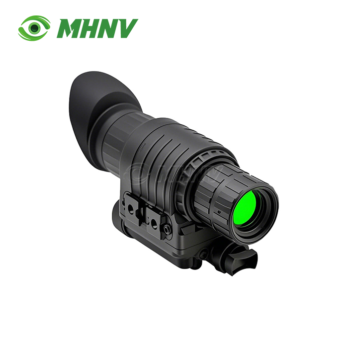
Today's observation devices up to 4kg can be mounted on a single mounting interface. Thermal binoculars, low-light cameras, day-time surveillance cameras and multi-sensor fusion devices are all directly mounted on the standardised platform.
No requirement for device-specific mounting for organisations with mixed observation fleets. This strategy reduces spare-parts stock and training complexity to a single line item. Maintenance crews have one set of spares, not individual kits for each family of devices.

Sub-Mil Positioning Accuracy for Automated Scanning Workflows
With 0.3 mil position accuracy and 1 mil repeatability, automated sector scanning and time-lapse change detection are possible. The operators define a number of observation sectors and automate regular sweeps of predefined coverage areas.
The platform points to the same pointing coordinate in different sessions. Manual pan-tilt heads without precision encoders wander 5-15 mil every pointing cycle. Such a drift makes it impossible to build automated or repeatable routines to observe.
Technical Specifications
| Parameter | Value |
|---|---|
| Model | MHNV MH-PTZ16 |
| Payload Capacity | ≥4 kg |
| Maximum Power | 20 W |
| Rated Power | 8.4 W |
| Azimuth Rotation | Continuous 360° |
| Pitch Range | −45° to +45° |
| Rotation Speed | 0.006°/s to 30°/s |
| Position Accuracy | ≤0.02° (0.3 mil) |
| Repeatability | ≤0.06° (1 mil) |
| Display | 2.95" color, 1200×1080 px |
| Storage | 128 GB standard, 2 TB optional |
| Coordinate Systems | WGS84, CGCS2000, SK42 |
| North Reference | Magnetic, true, grid |
| Video Input | CVBS, HDMI |
| Data Transmission | RTSP over IP |
| Self-Positioning | Multi-mode GNSS + compass |
| Dimensions | 180×135×220 mm |
| Weight | ≤4 kg |
| IP Rating | IP67 |
| Operating Temp | −40°C to +60°C |

Multi-Coordinate Output Eliminates Cross-Border Conversion Errors
Target grid readout is provided in WGS84, CGCS2000 and SK42 coordinate systems with magnetic, true and grid north references compatible with the mapping convention of any responding unit. Command posts, dispatch centers get coordinates in their own local system.
Operator-side coordinate conversion mistakes are avoided by fleets that operate across different national or organisational boundaries. Export deployments connect seamlessly to the destination country's existing mapping environment, with no need for unique firmware changes.
Continuously Variable Speed Range Supports Tracking and Slewing
The four decade speed range enables seamless tracking of slow moving targets at 0.006°/sec and quick slewing to new sectors at 30°/sec. Operators can control both functionalities from the same joystick or remote command without changing modes.
With fixed-speed positioners, you are forced to decide between smooth tracking and fast slewing. The Variable Speed Pan Tilt Unit offers both features at the same time and can rapidly adapt to the changing observation requirements.
Remote Operation via IP Streaming Keeps Personnel Protected
CVBS and HDMI inputs support live payload video. RTSP broadcasts video and telemetry over ordinary IP networks to laptops, ground stations or command posts at any network accessible distance.
Operators deploy the tripod at exposed observation areas and operate the platform from protected command posts miles away. Keep Personnel out of weather, hostile line of sight, and limited access areas, while keeping full observation capacity.
Target grid overlay on 128 GB on-board storage records continuous evidence-grade footage. Optional 2TB storage increases recording time for long-term surveillance missions and after-action evaluation.
IP67 Environmental Sealing for All-Weather Deployment
The equipment is sealed against dust and temporary water immersion with IP67-rated ingress protection. Reliable operation from −40°C to +60°C; from arctic winter patrols to desert summer deployments.
Rated power consumption is low 8.4W, suitable for long term static deployment on battery systems. Multi-day observation expeditions are possible without grid access because to solar charging panels and vehicle power supplies.

FAQ
Q: How does the product handle coordinate conversion between different mapping systems?
A: The MHNV MH-PTZ16 provides native support for WGS84, CGCS2000, and SK42 coordinate systems with selectable magnetic, true, and grid north references, automatically converting internal positioning data into the operator-selected coordinate framework and displaying target grids in the chosen convention without requiring external conversion software or manual calculation. This native multi-system capability prevents transcription errors when observation teams relay coordinates to responding units that use other national or organisational mapping standards, and it ensures exported target data will plug seamlessly into command-and-control networks already set up for a particular geodetic datum and north reference.
Q: Is it possible to set up automatic patrol patterns for perimeter protection on this platform?
A: Yes, sub-mil position precision and digital control interface allows the operators to establish waypoint sequences covering assigned sectors, program dwell periods at each waypoint, and run automatic cycle patrols returning the payload to each programd position with 1 mil repeatability. The platform’s patrol patterns are stored in non-volatile memory and it resumes interrupted sequences after power cycling, making it suitable for unattended perimeter monitoring where the system periodically scans fence lines, coastal boundaries or facility approaches and alerts operators only when the payload sensor detects motion or thermal anomalies within the programd field of regard.
Q: What video formats and resolutions does the RTSP stream support?
A: The RTSP output encapsulates H.264 or H.265 compressed video at resolutions matching the connected payload sensor, typically ranging from 720p to 1080p for thermal and low-light devices, with telemetry metadata embedded as ONVIF-compatible XML tags that include pan-tilt position, GPS coordinates, compass heading, and timestamp. Standard IP network equipment—switches, routers, and recording servers—handles the stream without proprietary decoders, and common video management software platforms display live feeds alongside archived footage, enabling integration into existing surveillance infrastructure without custom middleware.
Q: How does the unit maintain heading accuracy in magnetically noisy environments?
A: The integrated digital magnetic compass continuously cross-references magnetic heading against multi-frequency GNSS ground track and rate gyroscope data, applying Kalman filtering to detect and compensate for local magnetic distortions caused by steel structures, vehicle chassis, or underground utilities. When sustained magnetic anomalies exceed calibration thresholds, the system alerts the operator and switches to GPS-derived true north until the platform relocates to a magnetically clean environment, ensuring that target grid computations remain valid even when the compass sensor encounters interference.
Q: What is the expected service life of the pan-tilt mechanism under continuous duty cycles?
A: The precision brushless motor drives and zero-backlash gear trains are rated for 10,000 hours of continuous operation under rated load, equivalent to approximately 417 days of uninterrupted motion at typical surveillance duty cycles that include periodic slewing, tracking intervals, and static dwell periods. Regular lubrication at 2,000-hour intervals and replacement of wear-sensitive components such as slip rings and encoder bearings at 5,000 hours extend service life beyond the initial rating, and MHNV® provides field-replaceable drive modules that technicians can swap in under 30 minutes to minimize downtime during long-term deployments.

Contact Us for Customized Observation Solutions
Reach MHNV® technical team at sarah@mh-elec.com for Variable Speed Pan Tilt Unit payload integration consultation, coordinate system configuration, and delivery scheduling tailored to your operational requirements.
YOU MAY LIKE