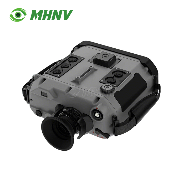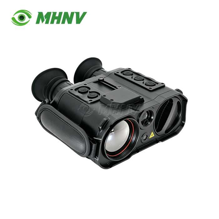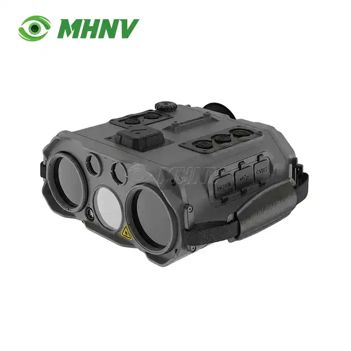
Multi-Sensor Target Location System
Multi-Sensor Target Location System with Thermal Imaging and Laser Rangefinder – Professional All-in-One Reconnaissance Solution
The MHNV® MH-MST5-TI Multi-Sensor Target Location System delivers enterprise-grade target acquisition through a five-channel architecture that integrates 7× direct-view optics, 800×600 low-light CMOS night vision, 640×512 thermal imaging, 10 km eye-safe laser rangefinder, and 850 nm laser target indicator in a single 1.75 kg IP67-rated housing. Designed for professional reconnaissance and forward observation, the system achieves <0.1 mrad angular resolution and real-time multi-GNSS positioning (GPS, GLONASS, Galileo, BeiDou), eliminating the 5–8 kg multi-device burden of legacy solutions while maintaining 24/7 all-weather operational capability across −40°C to +60°C thermal extremes.

Five-Channel Integration for Total Situational Awareness
The standard observation setups will have you carrying separate thermal monoculars, nite vision devices, laser rangefinders and designation pointers, adding 5-8 kg of dead weight and cognitive burden to your equipment. The MH-MST5-TI device integrates all five channels in one handheld unit, just 187×171×82 mm in size.
The 7 direct-view optics allow you to instantly see the real scene with zero latency, a field of vision of 5.86°, and reticle-based rough range even when the battery is dead. The low-light CMOS channel at 800x600 accommodates starlight and moonless circumstances with 1.0x to 8.0x continuous zoom over a 7.3x5.5 field. The thermal channel uses a 640×512 @ 12 μm detector behind a 40 mm F1.0 germanium lens. Field coverage is 11.0°×8.2° at 50 Hz refresh rate with same 1.0×–8.0× smooth zoom.
The suite is completed by the 1535 nm eye-safe laser rangefinder for 30 m to 10,000 m measurement on buildings, vehicles, aircraft and hard structures and the 850 nm ≥30 mW laser target indicator for covert IR pointer designation for NV-equipped teammates, drone coordination and multi-observer target confirmation.
Continuous Digital Zoom Preserves Identification Quality
Most thermal imagers have 1x/2x/4x step zoom. You lose the target in between and obtain mismatched pixel per target ratios. Our product provides genuine 1.0× to 8.0× continuous zoom on the low-light and thermal channels.
You select the exact magnification required for the distance and field-of-view requirements of the object without breaking observation. Coupled with high-resolution sensors – 640512 thermal and 800600 low-light – continuous zoom keeps useful identification-grade images available from close-in scanning at 1 wide field to long-range positive ID at 8 narrow field, all on the same channel.

Dual-Laser Architecture Completes the Engagement Cycle
If your legacy systems just have a rangefinder, you are limited to voice calls to describe targets. The MH-MST5-TI adds an 850 nm 30 mW laser target indicator to the 10 km LRF to close the engagement cycle in-device.
Set the target to 10,000 meters with the 1535 nm eye safe laser and line up the 850 nm indicator to the exact aim point. Your NV-equipped shooters, drone operators or second observers immediately see the IR point on THEIR own nite vision, minimising hand-off ambiguity and cutting time-to-first-round on time essential engagements. The dual-laser configuration makes the system an active coordination center rather than a passive observation device.
Multi-GNSS Positioning and 6000-Mil Reticle System
Precise own-position is required for precise target grids. The integrated multi-GNSS receiver tracks satellites from the GPS, GLONASS, Galileo and BeiDou constellations to provide reliable positioning in any area of operation such urban canyons, high latitudes or electromagnetic interference areas.
The 6000-mile compass reticle system computes target coordinates in the numerical language your fire-direction center already employs, combining laser range, own-position GNSS data and digital compass heading. You read the grid straight off the 1024×768 OLED, eliminating the errors of manual conversion and speeding up call-for-fire operations.
Complete Interface Suite for Command-Post and Vehicle Integration
The Multi-Sensor Target Location System is flexible beyond handheld usage with four interfaces: RS232, USB 2.0, CVBS (PAL) and HDMI, and an external 12 V±3 V power input. Live dual video feeds to vehicle displays or drone ground stations via HDMI, stored video downloads to command computers via USB, or position data to tactical networks via RS232.
On-board storage is up to 128GB (40 hours of dual-channel recording). Go up to 256GB, 512GB, 1TB or 2TB for even more after-action review. The power input from the outside is standard vehicle DC, so you may operate static observation for an endless length from a conceal or vehicle mount without running down the internal 4×18650 Li-ion battery pack.
Specifications
| Parameter | Value |
|---|---|
| Model | MHNV MH-MST5-TI |
| Architecture | Handheld all-in-one multi-sensor reconnaissance system |
| Optical Magnification | 7× |
| Optical Field of View | 5.86° (97 mil in 6000-mil system) |
| Night Vision Sensor | 800×600 CMOS @ 8 μm |
| Night Vision Magnification | 1.0×–8.0× continuous zoom |
| Night Vision FOV | 7.3°×5.5° (122×92 mil) |
| Thermal Detector | 640×512 @ 12 μm |
| Thermal Objective | 40 mm F1.0 germanium |
| Thermal Refresh Rate | 50 Hz |
| Thermal Magnification | 1.0×–8.0× continuous zoom |
| Thermal FOV | 11.0°×8.2° (183×137 mil) |
| Laser Rangefinder | 1535 nm eye-safe; 30 m–10,000 m |
| Laser Target Indicator | 850 nm; ≥30 mW |
| Display | 1024×768 OLED with reticle |
| Storage | ≥128 GB; optional 256 GB/512 GB/1 TB/2 TB |
| Interfaces | RS232, USB 2.0, CVBS (PAL), HDMI, 12 V±3 V external power |
| Battery | 4×18650 Li-ion 3.7 V |
| IP Rating | IP67 |
| Operating Temperature | −40°C to +60°C |
| Storage Temperature | −45°C to +70°C |
| Dimensions (L×W×H) | ≤187×171×82 mm |
| Weight (with batteries) | ≤1.75 kg |
IP67 Ruggedization for All-Weather Deployment
In the field, you will experience rain, dust, thermal shock, and high-vibration vehicle mounts. The MH-MST5-TI is IP67 rated for water immersion and dust, with an operating range of −40°C to +60°C and storage range of −45°C to +70°C. The precision mechanical design absorbs shock and vibration and maintains boresight alignment among all five channels, ensuring the thermal crosshair, LRF beam and laser indicator stay co-registered within sub-pixel margins for the product's lifetime.
FAQ
Q: How does the product maintain accuracy when sensors give conflicting readings?
A: The embedded fusion engine employs weighted Bayesian inference to assign real-time confidence levels based on sensor health, atmospheric conditions, and target signature strength. When the thermal channel detects a heat source obscured in the low-light channel by fog, the system prioritizes thermal data and flags the conflict on the OLED overlay. This algorithmic arbitration ensures you always act on the most reliable data stream, reducing false-alarm rates in cluttered or adverse-weather environments without manual intervention.
Q: Can I still range and observe if the thermal or night-vision channel fails?
A: Yes. The architecture supports graceful degradation. If the thermal detector experiences a fault, you retain full functionality in the 7× direct-view optics, low-light CMOS night vision, laser rangefinder, and laser indicator channels. The system recalculates circular-error-probable estimates using the remaining operational sensors and displays a status icon on the OLED. Field redundancy across five independent channels ensures mission continuity even under component-level failures.
Q: What is the recommended calibration and boresight interval for the laser and optical channels?
A: Factory boresight alignment is certified to <0.1 mrad and remains stable under normal use. We recommend field boresight verification every 1,000 operational hours or after significant thermal shock—such as rapid altitude changes or exposure to −40°C to +60°C swings within a single mission. The RS232 interface supports automated boresight routines using our calibration software, and the procedure takes under 10 minutes with a known-distance target board.
Q: Does the system comply with international environmental and data-security standards?
A: Yes. The MH-MST5-TI is designed to meet MIL-STD-810H vibration, shock, and thermal-cycling requirements and adheres to IP67 ingress protection. On-board data storage implements AES-256 encryption, aligning with ISO/IEC 27001 principles for secure handling of positional and video intelligence. Our quality-control process includes HASS/HALT stress screening to verify MTBF targets and electromagnetic-compatibility testing to maintain high signal-to-noise ratio in EMI-heavy zones.
Q: How long does the internal battery last, and can I hot-swap cells in the field?
A: The 4×18650 Li-ion pack delivers 4–6 hours of continuous dual-channel operation, depending on zoom usage and laser firing frequency. You can hot-swap batteries in under 30 seconds without powering down the system, preserving the GNSS lock and stored waypoints. For static observation or vehicle-mounted roles, connect the 12 V±3 V external power input to run indefinitely while the internal cells remain as backup.

Contact Us
Reach out to our engineering team at sarah@mh-elec.com for detailed datasheets, live demonstration videos, and OEM customization options tailored to your Multi-Sensor Target Location System operational requirements.
YOU MAY LIKE
.webp "Portable Target Acquisition System (TAS)")